★ 5766 pts. ♥ 0 likes ⬇ 2 saves
![[Gaming] Fallout game maps - 250 KB Tags: fallout, game, gaming, maps (Pict. in My r/GAMING favs)](http://t.im9.eu/gaming-fallout-game-maps.jpg) Full [Mildlyinteresting] Google Maps satellite imagery captured troop formations in Kim Il-sung Stadium, North KoreaPict. 1300×749 px
Full [Mildlyinteresting] Google Maps satellite imagery captured troop formations in Kim Il-sung Stadium, North KoreaPict. 1300×749 px★ -3162 pts. ♥ 0 likes ⬇ 15 saves
![[Mildlyinteresting] Google Maps satellite imagery captured troop formations in Kim Il-sung Stadium, North Korea - 238 KB Tags: captured, formations, google, imagery, kim, korea, maps, north, satellite, stadium, sung, troop (Pict. in My r/MILDLYINTERESTING favs)](http://t.im9.eu/mildlyinteresting-google-maps-satellite-imagery-captured-troop-formations-in-kim-il-sung-stadium-north-korea.jpg) Full [Mapporn] Two maps: [left] Results of the 1918 General Election which led to the Irish War of Independence, [right] the modern UPict. 1860×996 px
Full [Mapporn] Two maps: [left] Results of the 1918 General Election which led to the Irish War of Independence, [right] the modern UPict. 1860×996 px★ 11885 pts. ♥ 0 likes ⬇ 7 saves
![[Mapporn] Two maps: [left] Results of the 1918 General Election which led to the Irish War of Independence, [right] the modern U - 245 KB Tags: election, general, independence, irish, led, left, maps, modern, results, two, war (Pict. in My r/MAPS favs)](http://t.im9.eu/mapporn-two-maps-left-results-of-the-1918-general-election-which-led-to-the-irish-war-of-independence-right-the-modern-uk-ireland-border-1860x996.jpg) Full [Mapporn] Map of North America in the style of Tolkien's Middle-Earth maps (lotr) [1000x1200]Pict. 1000×1200 px
Full [Mapporn] Map of North America in the style of Tolkien's Middle-Earth maps (lotr) [1000x1200]Pict. 1000×1200 px★ 8841 pts. ♥ 0 likes ⬇ 2 saves
![[Mapporn] Map of North America in the style of Tolkien's Middle-Earth maps (lotr) [1000x1200] - 217 KB Tags: america, earth, lotr, map, maps, north, style, tolkien (Pict. in My r/MAPS favs)](http://t.im9.eu/mapporn-map-of-north-america-in-the-style-of-tolkien-s-middle-earth-maps-lotr-1000x1200.jpg) Full [Mapporn] Composite map of England in 1900 made with 360 seperate maps. (Extremely high resolution zoomable source in comments, Pict. 5786×6600 px
Full [Mapporn] Composite map of England in 1900 made with 360 seperate maps. (Extremely high resolution zoomable source in comments, Pict. 5786×6600 px★ 10329 pts. ♥ 0 likes ⬇ 7 saves
![[Mapporn] Composite map of England in 1900 made with 360 seperate maps. (Extremely high resolution zoomable source in comments, - 4.3 MB Tags: composite, england, extremely, high, map, maps, resolution, seperate, source, zoomable (Pict. in My r/MAPS favs)](http://t.im9.eu/mapporn-composite-map-of-england-in-1900-made-with-360-seperate-maps-extremely-high-resolution-zoomable-source-in-comments-also-versions-for-germany-in-1893-france-in-1750-london-in-1896-and-england-in-1947-in-comments-5786x6600.jpg) Full [Mapporn] [OC] Maps submitted to r-mapporn during 7 days, 25 most upvoted during that time in comments [3000x1489]Pict. 3000×1489 px
Full [Mapporn] [OC] Maps submitted to r-mapporn during 7 days, 25 most upvoted during that time in comments [3000x1489]Pict. 3000×1489 px★ 7833 pts. ♥ 0 likes ⬇ 5 saves
![[Mapporn] [OC] Maps submitted to r-mapporn during 7 days, 25 most upvoted during that time in comments [3000x1489] - 230 KB Tags: maps, submitted, time, upvoted (Pict. in My r/MAPS favs)](http://t.im9.eu/mapporn-oc-maps-submitted-to-r-mapporn-during-7-days-25-most-upvoted-during-that-time-in-comments-3000x1489.jpg) Full [Mapporn] Hand crafted topographical map of Banks Peninsula, New Zealand (Contour lines are at 100m intervals. More maps in commPict. 960×720 px
Full [Mapporn] Hand crafted topographical map of Banks Peninsula, New Zealand (Contour lines are at 100m intervals. More maps in commPict. 960×720 px★ 11970 pts. ♥ 0 likes ⬇ 18 saves
![[Mapporn] Hand crafted topographical map of Banks Peninsula, New Zealand (Contour lines are at 100m intervals. More maps in comm - 137 KB Tags: are, banks, comm, contour, crafted, hand, intervals, lines, map, maps, new, peninsula, topographical, zealand (Pict. in My r/MAPS favs)](http://t.im9.eu/mapporn-hand-crafted-topographical-map-of-banks-peninsula-new-zealand-contour-lines-are-at-100m-intervals-more-maps-in-comments-oc-960x720.jpg) Full [Mapporn] Design your own customized maps. This is Amsterdam [768x1024]Pict. 768×1024 px
Full [Mapporn] Design your own customized maps. This is Amsterdam [768x1024]Pict. 768×1024 px★ 8050 pts. ♥ 0 likes ⬇ 9 saves
![[Mapporn] Design your own customized maps. This is Amsterdam [768x1024] - 264 KB Tags: amsterdam, design, maps (Pict. in My r/MAPS favs)](http://t.im9.eu/mapporn-design-your-own-customized-maps-this-is-amsterdam-768x1024.jpg) Full [Mapporn] Three Approaches to the U.S.: WW-II era tilted perspective maps from viewpoints above Berlin, Tokyo, and Caracas. [161Pict. 1617×2074 px
Full [Mapporn] Three Approaches to the U.S.: WW-II era tilted perspective maps from viewpoints above Berlin, Tokyo, and Caracas. [161Pict. 1617×2074 px★ 10194 pts. ♥ 0 likes ⬇ 5 saves
![[Mapporn] Three Approaches to the U.S.: WW-II era tilted perspective maps from viewpoints above Berlin, Tokyo, and Caracas. [161 - 604 KB Tags: approaches, berlin, caracas, era, maps, perspective, tilted, tokyo, viewpoints (Pict. in My r/MAPS favs)](http://t.im9.eu/mapporn-three-approaches-to-the-u-s-ww-ii-era-tilted-perspective-maps-from-viewpoints-above-berlin-tokyo-and-caracas-1617-2074.jpg) Full [Mapporn] You can use the Google Maps' traffic feature to see where the winter storm has been. [640 x 1146]Pict. 640×1136 px
Full [Mapporn] You can use the Google Maps' traffic feature to see where the winter storm has been. [640 x 1146]Pict. 640×1136 px★ 8395 pts. ♥ 0 likes ⬇ 1 saves
![[Mapporn] You can use the Google Maps' traffic feature to see where the winter storm has been. [640 x 1146] - 226 KB Tags: feature, google, maps, storm, traffic, winter (Pict. in My r/MAPS favs)](http://t.im9.eu/mapporn-you-can-use-the-google-maps-traffic-feature-to-see-where-the-winter-storm-has-been-640-x-1146.jpg) Full [Funny] Fail caught on Google MapsGIF 400×246 px
Full [Funny] Fail caught on Google MapsGIF 400×246 px★ 5813 pts. ♥ 0 likes ⬇ 4 saves
![[Funny] Fail caught on Google Maps - 902 KB Tags: caught, fail, funny, google, maps (GIF in My r/FUNNY favs)](http://t.im9.eu/funny-fail-caught-on-google-maps.jpg) Full [Mapporn] Alternate history maps of America. [1,853x8,537]Pict. 1853×8537 px
Full [Mapporn] Alternate history maps of America. [1,853x8,537]Pict. 1853×8537 px★ 8612 pts. ♥ 0 likes ⬇ 11 saves
![[Mapporn] Alternate history maps of America. [1,853x8,537] - 2.5 MB Tags: 853x8, alternate, america, history, maps (Pict. in My r/MAPS favs)](http://t.im9.eu/mapporn-alternate-history-maps-of-america-1-853x8-537.jpg) Full [Mapporn] Africa in Maps, made by Richard Edes Harrison, Sept. 1941 [5089x3214]Pict. 5089×3214 px
Full [Mapporn] Africa in Maps, made by Richard Edes Harrison, Sept. 1941 [5089x3214]Pict. 5089×3214 px★ 8183 pts. ♥ 0 likes ⬇ 4 saves
![[Mapporn] Africa in Maps, made by Richard Edes Harrison, Sept. 1941 [5089x3214] - 4.3 MB Tags: africa, harrison, maps, richard, sept (Pict. in My r/MAPS favs)](http://t.im9.eu/mapporn-africa-in-maps-made-by-richard-edes-harrison-sept-1941-5089x3214.jpg) Full [Funny] Google Maps Street View is dead serious about privacyPict. 500×356 px
Full [Funny] Google Maps Street View is dead serious about privacyPict. 500×356 px★ 5531 pts. ♥ 0 likes ⬇ 3 saves
![[Funny] Google Maps Street View is dead serious about privacy - 41 KB Tags: dead, funny, google, maps, privacy, street (Pict. in My r/FUNNY favs)](http://t.im9.eu/funny-google-maps-street-view-is-dead-serious-about-privacy.jpg) Full [Mapporn] The sub asks for interesting maps: this map I found online is interestingly wrong! [1050x1443]Pict. 1050×1443 px
Full [Mapporn] The sub asks for interesting maps: this map I found online is interestingly wrong! [1050x1443]Pict. 1050×1443 px★ 9826 pts. ♥ 0 likes ⬇ 10 saves
![[Mapporn] The sub asks for interesting maps: this map I found online is interestingly wrong! [1050x1443] - 175 KB Tags: asks, interesting, interestingly, map, maps, online, sub, wrong (Pict. in My r/MAPS favs)](http://t.im9.eu/mapporn-the-sub-asks-for-interesting-maps-this-map-i-found-online-is-interestingly-wrong-1050x1443.jpg) Full [Mapporn] [1380x1206] I Make Artistic Maps For Civilization V. This One Is An Updated Map For Spain Under Isabella.Pict. 1206×1380 px
Full [Mapporn] [1380x1206] I Make Artistic Maps For Civilization V. This One Is An Updated Map For Spain Under Isabella.Pict. 1206×1380 px★ 9514 pts. ♥ 0 likes ⬇ 9 saves
![[Mapporn] [1380x1206] I Make Artistic Maps For Civilization V. This One Is An Updated Map For Spain Under Isabella. - 383 KB Tags: artistic, civilization, isabella, map, maps, one, spain, updated (Pict. in My r/MAPS favs)](http://t.im9.eu/mapporn-1380x1206-i-make-artistic-maps-for-civilization-v-this-one-is-an-updated-map-for-spain-under-isabella.jpg) Full [Mapporn] 9 maps showing the largest ethnicities in the United States by home address [2,997x1,688]Pict. 2997×1688 px
Full [Mapporn] 9 maps showing the largest ethnicities in the United States by home address [2,997x1,688]Pict. 2997×1688 px★ 9253 pts. ♥ 0 likes ⬇ 6 saves
![[Mapporn] 9 maps showing the largest ethnicities in the United States by home address [2,997x1,688] - 882 KB Tags: 997x1, address, ethnicities, largest, maps, showing, states, united (Pict. in My r/MAPS favs)](http://t.im9.eu/mapporn-9-maps-showing-the-largest-ethnicities-in-the-united-states-by-home-address-2-997x1-688.jpg) Full [Funny] So I've been clean for a while and I decided to look at the old dope spot on Google maps. Was not disappointed or surpriPict. 645×536 px
Full [Funny] So I've been clean for a while and I decided to look at the old dope spot on Google maps. Was not disappointed or surpriPict. 645×536 px★ 7078 pts. ♥ 0 likes ⬇ 4 saves
![[Funny] So I've been clean for a while and I decided to look at the old dope spot on Google maps. Was not disappointed or surpri - 80 KB Tags: clean, decided, disappointed, dope, funny, google, maps, old, spot, surpri (Pict. in My r/FUNNY favs)](http://t.im9.eu/funny-so-i-ve-been-clean-for-a-while-and-i-decided-to-look-at-the-old-dope-spot-on-google-maps-was-not-disappointed-or-surprised.jpg) Full [Mildlyinteresting] This lot is for sale on google mapsPict. 1080×1920 px
Full [Mildlyinteresting] This lot is for sale on google mapsPict. 1080×1920 px★ -8701 pts. ♥ 0 likes ⬇ 4 saves
![[Mildlyinteresting] This lot is for sale on google maps - 352 KB Tags: for, google, lot, maps, sale (Pict. in My r/MILDLYINTERESTING favs)](http://t.im9.eu/mildlyinteresting-this-lot-is-for-sale-on-google-maps.jpg) Full [Pics] My mate does incredible portraits on maps 3Pict. 700×762 px
Full [Pics] My mate does incredible portraits on maps 3Pict. 700×762 px★ 10909 pts. ♥ 0 likes ⬇ 2 saves
![[Pics] My mate does incredible portraits on maps 3 - 194 KB Tags: incredible, maps, mate, portraits (Pict. in My r/PICS favs)](http://t.im9.eu/pics-my-mate-does-incredible-portraits-on-maps-3.jpg) Full [Mapporn] We've all seen maps of landlocked countries...here's a map of landlocked first level administrative divisions [4972x25Pict. 4972×2517 px
Full [Mapporn] We've all seen maps of landlocked countries...here's a map of landlocked first level administrative divisions [4972x25Pict. 4972×2517 px★ 9252 pts. ♥ 0 likes ⬇ 9 saves
![[Mapporn] We've all seen maps of landlocked countries...here's a map of landlocked first level administrative divisions [4972x25 - 261 KB Tags: administrative, countries, divisions, landlocked, level, map, maps (Pict. in My r/MAPS favs)](http://t.im9.eu/mapporn-we-ve-all-seen-maps-of-landlocked-countries-here-s-a-map-of-landlocked-first-level-administrative-divisions-4972x2517.jpg) Full maps-and-keys-chartPict. 603×735 px
Full maps-and-keys-chartPict. 603×735 px★ 4851 pts. ♥ 0 likes ⬇ 9 saves
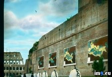
 Full Rome. Basilica of Maxentius and Constantine (Basilica Nova) - north side, with maps of the Roman Empire (1919-1938).3208Pict. 799×748 px
★ 13508 pts. ♥ 0 likes ⬇ 5 saves
 Full [Mapporn] Blowfish: Use of 'Sick' Days by State [1063x765] (Source & More Maps in Comments)Pict. 1063×765 px
★ 7000 pts. ♥ 0 likes ⬇ 10 saves
![[Mapporn] Blowfish: Use of 'Sick' Days by State [1063x765] (Source & More Maps in Comments) - 128 KB Tags: maps, sick, source, state (Pict. in My r/MAPS favs)](http://t.im9.eu/mapporn-blowfish-use-of-sick-days-by-state-1063x765-source-more-maps-in-comments.jpg)