★ 342379 pts. ♥ 0 likes ⬇ 4 saves
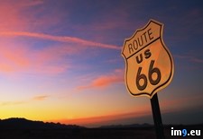
 Full Route 66 SunsetPict. 1600×1200 px
★ 340874 pts. ♥ 0 likes ⬇ 5 saves
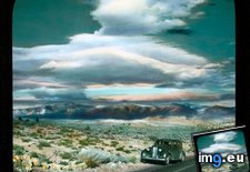
 Full Death Valley, California. Towne's Pass, State Route 190 - view of the road, with Branson DeCou and his car (1920-1935).2247Pict. 799×736 px
★ 13518 pts. ♥ 0 likes ⬇ 7 saves
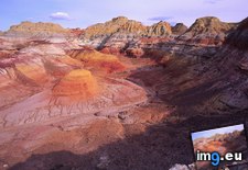
 Full Desert Hills Surrounding Silk Road Route, Xinjiang Uygur, ChinaPict. 1600×1200 px
★ 342506 pts. ♥ 0 likes ⬇ 9 saves
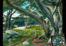
 Full Monterey County, California. 17-Mile Drive, a scenic route from Carmel to Pacific Grove - large tree (1920-1940).1374Pict. 799×752 px
★ 13281 pts. ♥ 0 likes ⬇ 7 saves
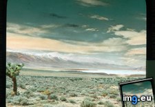
 Full Mojave Desert, California. Owen's Lake - view from State Route 190 near Darwin (1920-1940).2294Pict. 799×745 px
★ 11377 pts. ♥ 0 likes ⬇ 4 saves
 Full Us RoutePict. 1024×768 px
★ 91639 pts. ♥ 0 likes ⬇ 3 saves
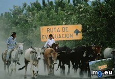
 Full Evacuation RoutePict. 1024×768 px
★ 94036 pts. ♥ 0 likes ⬇ 4 saves
 Full [Mildlyinteresting] So apparantly on a trip from Berlin to Singapore you save two hours if you take the route via Kazakhstan insPict. 1280×598 px
★ -6515 pts. ♥ 0 likes ⬇ 12 saves
![[Mildlyinteresting] So apparantly on a trip from Berlin to Singapore you save two hours if you take the route via Kazakhstan ins - 128 KB Tags: apparantly, berlin, hours, ins, kazakhstan, route, save, singapore, trip, two, via, you (Pict. in My r/MILDLYINTERESTING favs)](http://t.im9.eu/mildlyinteresting-so-apparantly-on-a-trip-from-berlin-to-singapore-you-save-two-hours-if-you-take-the-route-via-kazakhstan-instead-of-taking-the-route-via-iran.jpg) Full RoutePict. 1024×768 px
Full RoutePict. 1024×768 px★ 92844 pts. ♥ 0 likes ⬇ 1 saves
 Full Los Angeles County, California - Ridge Route over San Gabriel and Tehachapi Mountains in northern Los Angeles county (1929).2046Pict. 799×745 px
★ 13365 pts. ♥ 0 likes ⬇ 5 saves
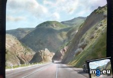 Full [Earthporn] Took a detour route around Kamloops and found this stunning lake. British Columbia, Canada. [OC] [2048x345]Pict. 2048×345 px
★ 343688 pts. ♥ 0 likes ⬇ 8 saves
![[Earthporn] Took a detour route around Kamloops and found this stunning lake. British Columbia, Canada. [OC] [2048x345] - 219 KB Tags: british, canada, columbia, detour, kamloops, lake, route, stunning (Pict. in My r/EARTHPORN favs)](http://t.im9.eu/earthporn-took-a-detour-route-around-kamloops-and-found-this-stunning-lake-british-columbia-canada-oc-2048x345.jpg) Full [Mapporn] Santa's delivery route over Australia according to the Air Services Australia flight plan. [720x360]Pict. 720×360 px
Full [Mapporn] Santa's delivery route over Australia according to the Air Services Australia flight plan. [720x360]Pict. 720×360 px★ 8087 pts. ♥ 0 likes ⬇ 5 saves
![[Mapporn] Santa's delivery route over Australia according to the Air Services Australia flight plan. [720x360] - 46 KB Tags: air, australia, delivery, flight, plan, route, santa, services (Pict. in My r/MAPS favs)](http://t.im9.eu/mapporn-santa-s-delivery-route-over-australia-according-to-the-air-services-australia-flight-plan-720x360.jpg) Full [Earthporn] Early Vermont Snow, off Route 100 Near Okemo [3686X869]Pict. 3686×869 px
Full [Earthporn] Early Vermont Snow, off Route 100 Near Okemo [3686X869]Pict. 3686×869 px★ 341748 pts. ♥ 0 likes ⬇ 9 saves
![[Earthporn] Early Vermont Snow, off Route 100 Near Okemo [3686X869] - 606 KB Tags: early, off, okemo, route, snow, vermont (Pict. in My r/EARTHPORN favs)](http://t.im9.eu/earthporn-early-vermont-snow-off-route-100-near-okemo-3686x869.jpg) Full [Earthporn] I had to climb up to find an easy route out yesterday - Castle Hill, Canterbury, New Zealand [OC] [7000x2583]Pict. 7000×2583 px
Full [Earthporn] I had to climb up to find an easy route out yesterday - Castle Hill, Canterbury, New Zealand [OC] [7000x2583]Pict. 7000×2583 px★ 342244 pts. ♥ 0 likes ⬇ 9 saves
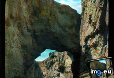
![[Earthporn] I had to climb up to find an easy route out yesterday - Castle Hill, Canterbury, New Zealand [OC] [7000x2583] - 1.7 MB Tags: canterbury, castle, climb, easy, find, hill, route, zealand (Pict. in My r/EARTHPORN favs)](http://t.im9.eu/earthporn-i-had-to-climb-up-to-find-an-easy-route-out-yesterday-castle-hill-canterbury-new-zealand-oc-7000x2583.jpg) Full Death Valley, California. Natural Bridge, off of State Route 190 - view with visitors and cars underneath (1920-1940).2248Pict. 799×739 px
Full Death Valley, California. Natural Bridge, off of State Route 190 - view with visitors and cars underneath (1920-1940).2248Pict. 799×739 px★ 11621 pts. ♥ 0 likes ⬇ 7 saves
 Full [Mapporn] 1780 map of eastern Spain, with Don Quixote's route drawn in [5027x3295]Pict. 2514×1648 px
★ 5589 pts. ♥ 0 likes ⬇ 3 saves
![[Mapporn] 1780 map of eastern Spain, with Don Quixote's route drawn in [5027x3295] - 993 KB Tags: drawn, eastern, map, route, spain (Pict. in My r/MAPS favs)](http://t.im9.eu/mapporn-1780-map-of-eastern-spain-with-don-quixote-s-route-drawn-in-5027x3295.jpg) Full [Mapporn] 'A correct map of the United States showing the Union Pacific, the overland route and connections' Published in 1892 [Pict. 2092×1535 px
Full [Mapporn] 'A correct map of the United States showing the Union Pacific, the overland route and connections' Published in 1892 [Pict. 2092×1535 px★ 10229 pts. ♥ 0 likes ⬇ 5 saves
![[Mapporn] 'A correct map of the United States showing the Union Pacific, the overland route and connections' Published in 1892 [ - 923 KB Tags: connections, correct, map, overland, pacific, published, route, showing, states, union, united (Pict. in My r/MAPS favs)](http://t.im9.eu/mapporn-a-correct-map-of-the-united-states-showing-the-union-pacific-the-overland-route-and-connections-published-in-1892-2092-x-1535.jpg) Full [Earthporn] Beautiful route through the trees. Big White, Kelowna [768x768] by Beth PPict. 768×768 px
Full [Earthporn] Beautiful route through the trees. Big White, Kelowna [768x768] by Beth PPict. 768×768 px★ 341478 pts. ♥ 0 likes ⬇ 6 saves
![[Earthporn] Beautiful route through the trees. Big White, Kelowna [768x768] by Beth P - 130 KB Tags: 768x768, beautiful, beth, big, route, trees, white (Pict. in My r/EARTHPORN favs)](http://t.im9.eu/earthporn-beautiful-route-through-the-trees-big-white-kelowna-768x768-by-beth-p.jpg) Full [Mapporn] Helicopter Route Chart and location of Heliports, New York City region, circa 1988. [2000×1259]Pict. 2000×1259 px
Full [Mapporn] Helicopter Route Chart and location of Heliports, New York City region, circa 1988. [2000×1259]Pict. 2000×1259 px★ 8914 pts. ♥ 0 likes ⬇ 6 saves
![[Mapporn] Helicopter Route Chart and location of Heliports, New York City region, circa 1988. [2000×1259] - 595 KB Tags: chart, circa, city, helicopter, heliports, location, region, route, york (Pict. in My r/MAPS favs)](http://t.im9.eu/mapporn-helicopter-route-chart-and-location-of-heliports-new-york-city-region-circa-1988-2000-1259.jpg) Full [Mapporn] Distribution of the term route by region in the continental US. [954X600]Pict. 954×600 px
Full [Mapporn] Distribution of the term route by region in the continental US. [954X600]Pict. 954×600 px★ 8163 pts. ♥ 0 likes ⬇ 5 saves
![[Mapporn] Distribution of the term route by region in the continental US. [954X600] - 75 KB Tags: 954x600, continental, distribution, region, route, term (Pict. in My r/MAPS favs)](http://t.im9.eu/mapporn-distribution-of-the-term-route-by-region-in-the-continental-us-954x600.jpg) Full [Pics] U.S. Route 50 - Known as America's most lonely roadPict. 600×450 px
Full [Pics] U.S. Route 50 - Known as America's most lonely roadPict. 600×450 px★ 11374 pts. ♥ 0 likes ⬇ 8 saves
![[Pics] U.S. Route 50 - Known as America's most lonely road - 64 KB Tags: america, lonely, road, route (Pict. in My r/PICS favs)](http://t.im9.eu/pics-u-s-route-50-known-as-america-s-most-lonely-road.jpg) Full [Mapporn] Che Guevara’s Route Through South America - Motorcycle Diaries [1500x5132]Pict. 1500×5132 px
Full [Mapporn] Che Guevara’s Route Through South America - Motorcycle Diaries [1500x5132]Pict. 1500×5132 px★ 7166 pts. ♥ 0 likes ⬇ 5 saves
![[Mapporn] Che Guevara’s Route Through South America - Motorcycle Diaries [1500x5132] - 865 KB Tags: america, che, diaries, motorcycle, route, south (Pict. in My r/MAPS favs)](http://t.im9.eu/mapporn-che-guevara-s-route-through-south-america-motorcycle-diaries-1500x5132.jpg) Full [Gaming] I went the more economic routePict. 400×285 px
Full [Gaming] I went the more economic routePict. 400×285 px★ -1035 pts. ♥ 0 likes ⬇ 6 saves
![[Gaming] I went the more economic route - 15 KB Tags: economic, gaming, route (Pict. in My r/GAMING favs)](http://t.im9.eu/gaming-i-went-the-more-economic-route.jpg)