Pict. [Earthporn] Map of Scotland (Loch Garry) [OC] [3467 × 2352] (#Map #Scotland #Garry #Loch)Pict. 3120×2116 px![[Earthporn] Map of Scotland (Loch Garry) [OC] [3467 × 2352] (#Map #Scotland #Garry #Loch) - 889 KB Tags: garry, loch, map, scotland (Pict. in My r/EARTHPORN favs)](https://t.im9.eu/earthporn-map-of-scotland-loch-garry-oc-3467-2352.jpg) Pict. Earth Map Dual Monitor Other HD Wallpaper (#Wallpaper #Map #Earth #Dual #Monitor)Pict. 2560×1024 px
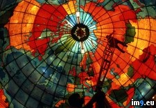
Pict. Earth Map Dual Monitor Other HD Wallpaper (#Wallpaper #Map #Earth #Dual #Monitor)Pict. 2560×1024 px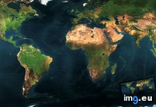 Pict. Stained Glass Map (#Map #Glass #Stained)Pict. 1024×768 px
 Pict. [Mapporn] Magellan's Circumnavigation of the Earth, from the Portolan Atlas by Battista Agnese, c. 1544. [2235x1482] (#Old #Map #Earth #Atlas)Pict. 2235×1482 px
![[Mapporn] Magellan's Circumnavigation of the Earth, from the Portolan Atlas by Battista Agnese, c. 1544. [2235x1482] (#Old #Map #Earth #Atlas) - 574 KB Tags: atlas, earth, map, old (Pict. in My r/MAPS favs)](https://t.im9.eu/mapporn-magellan-s-circumnavigation-of-the-earth-from-the-portolan-atlas-by-battista-agnese-c-1544-2235x1482.jpg) Pict. Rome. Basilica of Maxentius and Constantine (Basilica Nova) - north side detail, map of Rome during the Punic Wars (1919-1938).3 (#Map #North #Wars #Basilica #Constantine #Maxentius #Punic)Pict. 799×748 px
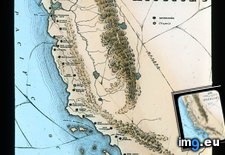
Pict. Rome. Basilica of Maxentius and Constantine (Basilica Nova) - north side detail, map of Rome during the Punic Wars (1919-1938).3 (#Map #North #Wars #Basilica #Constantine #Maxentius #Punic)Pict. 799×748 px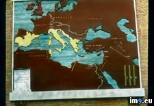 Pict. California - map showing the location of the Missions, from unknown printed source (1920-1940).1684 (#Source #Map #California #Location #Missions)Pict. 799×960 px
 Pict. [Pics] My wife made this star map shawl. It is beaded with over 350 beads to represent the night sky as seen from the North Pole (#Wife #Night #Map #Star #Shawl #Beaded #Represent)Pict. 960×552 px
![[Pics] My wife made this star map shawl. It is beaded with over 350 beads to represent the night sky as seen from the North Pole (#Wife #Night #Map #Star #Shawl #Beaded #Represent) - 90 KB Tags: beaded, beads, map, night, north, pole, represent, shawl, sky, star, wife (Pict. in My r/PICS favs)](https://t.im9.eu/pics-my-wife-made-this-star-map-shawl-it-is-beaded-with-over-350-beads-to-represent-the-night-sky-as-seen-from-the-north-pole-1.jpg) Pict. [Pics] My wife made this star map shawl. It is beaded with over 350 beads to represent the night sky as seen from the North Pole (#Wife #Night #Map #Star #Shawl #Beaded #Represent)Pict. 640×640 px
Pict. [Pics] My wife made this star map shawl. It is beaded with over 350 beads to represent the night sky as seen from the North Pole (#Wife #Night #Map #Star #Shawl #Beaded #Represent)Pict. 640×640 px![[Pics] My wife made this star map shawl. It is beaded with over 350 beads to represent the night sky as seen from the North Pole (#Wife #Night #Map #Star #Shawl #Beaded #Represent) - 54 KB Tags: beaded, beads, map, night, north, pole, represent, shawl, sky, star, wife (Pict. in My r/PICS favs)](https://t.im9.eu/pics-my-wife-made-this-star-map-shawl-it-is-beaded-with-over-350-beads-to-represent-the-night-sky-as-seen-from-the-north-pole-4.jpg) Pict. [Pics] My wife made this star map shawl. It is beaded with over 350 beads to represent the night sky as seen from the North Pole (#Wife #Night #Map #Star #Shawl #Beaded #Represent)Pict. 642×960 px
Pict. [Pics] My wife made this star map shawl. It is beaded with over 350 beads to represent the night sky as seen from the North Pole (#Wife #Night #Map #Star #Shawl #Beaded #Represent)Pict. 642×960 px![[Pics] My wife made this star map shawl. It is beaded with over 350 beads to represent the night sky as seen from the North Pole (#Wife #Night #Map #Star #Shawl #Beaded #Represent) - 57 KB Tags: beaded, beads, map, night, north, pole, represent, shawl, sky, star, wife (Pict. in My r/PICS favs)](https://t.im9.eu/pics-my-wife-made-this-star-map-shawl-it-is-beaded-with-over-350-beads-to-represent-the-night-sky-as-seen-from-the-north-pole-6.jpg) Pict. [Pics] My wife made this star map shawl. It is beaded with over 350 beads to represent the night sky as seen from the North Pole (#Wife #Night #Map #Star #Shawl #Beaded #Represent)Pict. 642×960 px
Pict. [Pics] My wife made this star map shawl. It is beaded with over 350 beads to represent the night sky as seen from the North Pole (#Wife #Night #Map #Star #Shawl #Beaded #Represent)Pict. 642×960 px![[Pics] My wife made this star map shawl. It is beaded with over 350 beads to represent the night sky as seen from the North Pole (#Wife #Night #Map #Star #Shawl #Beaded #Represent) - 73 KB Tags: beaded, beads, map, night, north, pole, represent, shawl, sky, star, wife (Pict. in My r/PICS favs)](https://t.im9.eu/pics-my-wife-made-this-star-map-shawl-it-is-beaded-with-over-350-beads-to-represent-the-night-sky-as-seen-from-the-north-pole-3.jpg) Pict. [Pics] My wife made this star map shawl. It is beaded with over 350 beads to represent the night sky as seen from the North Pole (#Wife #Night #Map #Star #Shawl #Beaded #Represent)Pict. 642×960 px
Pict. [Pics] My wife made this star map shawl. It is beaded with over 350 beads to represent the night sky as seen from the North Pole (#Wife #Night #Map #Star #Shawl #Beaded #Represent)Pict. 642×960 px![[Pics] My wife made this star map shawl. It is beaded with over 350 beads to represent the night sky as seen from the North Pole (#Wife #Night #Map #Star #Shawl #Beaded #Represent) - 112 KB Tags: beaded, beads, map, night, north, pole, represent, shawl, sky, star, wife (Pict. in My r/PICS favs)](https://t.im9.eu/pics-my-wife-made-this-star-map-shawl-it-is-beaded-with-over-350-beads-to-represent-the-night-sky-as-seen-from-the-north-pole-5.jpg) Pict. [Pics] My wife made this star map shawl. It is beaded with over 350 beads to represent the night sky as seen from the North Pole (#Wife #Night #Map #Star #Shawl #Beaded #Represent)Pict. 642×960 px
Pict. [Pics] My wife made this star map shawl. It is beaded with over 350 beads to represent the night sky as seen from the North Pole (#Wife #Night #Map #Star #Shawl #Beaded #Represent)Pict. 642×960 px![[Pics] My wife made this star map shawl. It is beaded with over 350 beads to represent the night sky as seen from the North Pole (#Wife #Night #Map #Star #Shawl #Beaded #Represent) - 79 KB Tags: beaded, beads, map, night, north, pole, represent, shawl, sky, star, wife (Pict. in My r/PICS favs)](https://t.im9.eu/pics-my-wife-made-this-star-map-shawl-it-is-beaded-with-over-350-beads-to-represent-the-night-sky-as-seen-from-the-north-pole-2.jpg) Pict. mapporn-all-the-water-on-earth-presented-as-a-sphere-it-would-have-a-diameter-of-about-860-miles-and-a-volume-around-332-500-000-cubic-miles-1600-1534 (#World #White #Map #Europe #Water #Volume #Miles #Geography #Statistics #Presented #Diameter #Sphere #Cubic)Pict. 950×911 px
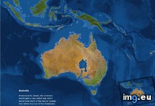
Pict. mapporn-all-the-water-on-earth-presented-as-a-sphere-it-would-have-a-diameter-of-about-860-miles-and-a-volume-around-332-500-000-cubic-miles-1600-1534 (#World #White #Map #Europe #Water #Volume #Miles #Geography #Statistics #Presented #Diameter #Sphere #Cubic)Pict. 950×911 px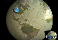 Pict. mapporn-what-australia-and-surrounding-territories-would-look-like-if-all-the-ice-on-earth-were-to-melt-australia-1-024px-766px (#White #Map #Wide #Europe #Ice #Earth #Asia #Territories #Melt #Stats #Surrounding #Statistics)Pict. 1024×766 px
 Pict. [Pics] This picture of a lava lake sort of reminds me of a map of the world. (#Picture #World #Sort #Lava #Reminds)Pict. 720×480 px
![[Pics] This picture of a lava lake sort of reminds me of a map of the world. (#Picture #World #Sort #Lava #Reminds) - 77 KB Tags: lake, lava, map, picture, reminds, sort, world (Pict. in My r/PICS favs)](https://t.im9.eu/pics-this-picture-of-a-lava-lake-sort-of-reminds-me-of-a-map-of-the-world.jpg) Pict. Northern Italy - Lake Region map (1919-1938).2886 (#Map #Lake #Italy #Northern #Region)Pict. 799×748 px
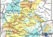
Pict. Northern Italy - Lake Region map (1919-1938).2886 (#Map #Lake #Italy #Northern #Region)Pict. 799×748 px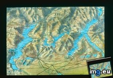 Pict. mapporn-population-loss-caused-by-war-and-disease-during-the-thirty-years-war-947-1076 (#Years #World #White #Map #Wide #Europe #Asia #Disease #Caused #Geography #Loss)Pict. 947×1076 px
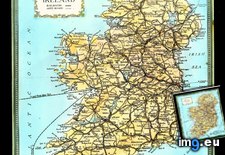
 Pict. Ireland - map of Ireland, with shipping lines (1932-1935).4355 (#Map #Lines #Ireland #Shipping)Pict. 799×876 px
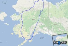
 Pict. mapporn-the-island-of-madagascar-compared-to-alaska-543-524 (#World #White #Map #Wide #Europe #Maps #Asia #Compared #Geography #Stats #Madagascar)Pict. 543×524 px
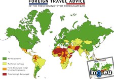
 Pict. mapporn-foreign-travel-advice-of-the-french-ministry-of-foreign-affairs-5600-4130-oc (#World #Map #French #Europe #Usa #Asia #Foreign #Geography #Stats #Affairs #Ministry)Pict. 5600×4137 px
 Pict. [Mapporn] Hand crafted topographical map of Banks Peninsula, New Zealand (Contour lines are at 100m intervals. More maps in comm (#New #Map #Are #Hand #Lines #Comm #Contour #Crafted #Intervals)Pict. 960×720 px
![[Mapporn] Hand crafted topographical map of Banks Peninsula, New Zealand (Contour lines are at 100m intervals. More maps in comm (#New #Map #Are #Hand #Lines #Comm #Contour #Crafted #Intervals) - 137 KB Tags: are, banks, comm, contour, crafted, hand, intervals, lines, map, maps, new, peninsula, topographical, zealand (Pict. in My r/MAPS favs)](https://t.im9.eu/mapporn-hand-crafted-topographical-map-of-banks-peninsula-new-zealand-contour-lines-are-at-100m-intervals-more-maps-in-comments-oc-960x720.jpg) Pict. [Mapporn] World Map With Lines Joining Constituent Countries, Overseas Departments, and Non-Contiguous States and Territories to (#World #Map #Non #Lines #Territories #Overseas #Departments #Constituent)Pict. 2638×1196 px
Pict. [Mapporn] World Map With Lines Joining Constituent Countries, Overseas Departments, and Non-Contiguous States and Territories to (#World #Map #Non #Lines #Territories #Overseas #Departments #Constituent)Pict. 2638×1196 px![[Mapporn] World Map With Lines Joining Constituent Countries, Overseas Departments, and Non-Contiguous States and Territories to (#World #Map #Non #Lines #Territories #Overseas #Departments #Constituent) - 255 KB Tags: constituent, contiguous, countries, departments, joining, lines, map, non, overseas, states, territories, world (Pict. in My r/MAPS favs)](https://t.im9.eu/mapporn-world-map-with-lines-joining-constituent-countries-overseas-departments-and-non-contiguous-states-and-territories-to-their-respective-countries-2638x1196-oc.jpg) Pict. [Mapporn] World Map showing the full extent of the European Union (including its Outermost Regions), its Overseas Countries and (#World #Map #Full #Showing #Including #Extent #Overseas #Outermost)Pict. 2206×1358 px
Pict. [Mapporn] World Map showing the full extent of the European Union (including its Outermost Regions), its Overseas Countries and (#World #Map #Full #Showing #Including #Extent #Overseas #Outermost)Pict. 2206×1358 px![[Mapporn] World Map showing the full extent of the European Union (including its Outermost Regions), its Overseas Countries and (#World #Map #Full #Showing #Including #Extent #Overseas #Outermost) - 288 KB Tags: countries, european, extent, full, including, map, outermost, overseas, regions, showing, union, world (Pict. in My r/MAPS favs)](https://t.im9.eu/mapporn-world-map-showing-the-full-extent-of-the-european-union-including-its-outermost-regions-its-overseas-countries-and-territories-exclusive-economic-zones-and-antarctic-claims-2206x1358.jpg) Pict. [Pics] This map has hung in my firehouse for years. I just looked at it for the first time. (#Time #Years #Map #Looked #Hung)Pict. 2448×3264 px
Pict. [Pics] This map has hung in my firehouse for years. I just looked at it for the first time. (#Time #Years #Map #Looked #Hung)Pict. 2448×3264 px![[Pics] This map has hung in my firehouse for years. I just looked at it for the first time. (#Time #Years #Map #Looked #Hung) - 768 KB Tags: hung, looked, map, time, years (Pict. in My r/PICS favs)](https://t.im9.eu/pics-this-map-has-hung-in-my-firehouse-for-years-i-just-looked-at-it-for-the-first-time.jpg)
★ 338k pts. ♥ 0 likes ⬇ 3 saves
![[Earthporn] Map of Scotland (Loch Garry) [OC] [3467 × 2352] (#Map #Scotland #Garry #Loch) - 889 KB Tags: garry, loch, map, scotland (Pict. in My r/EARTHPORN favs)](https://t.im9.eu/earthporn-map-of-scotland-loch-garry-oc-3467-2352.jpg) Pict. Earth Map Dual Monitor Other HD Wallpaper (#Wallpaper #Map #Earth #Dual #Monitor)Pict. 2560×1024 px
Pict. Earth Map Dual Monitor Other HD Wallpaper (#Wallpaper #Map #Earth #Dual #Monitor)Pict. 2560×1024 px★ 105k pts. ♥ 0 likes ⬇ 11 saves
 Pict. Stained Glass Map (#Map #Glass #Stained)Pict. 1024×768 px
★ 90k pts. ♥ 0 likes ⬇ 13 saves
 Pict. [Mapporn] Magellan's Circumnavigation of the Earth, from the Portolan Atlas by Battista Agnese, c. 1544. [2235x1482] (#Old #Map #Earth #Atlas)Pict. 2235×1482 px
★ 52k pts. ♥ 1 likes ⬇ 17 saves
![[Mapporn] Magellan's Circumnavigation of the Earth, from the Portolan Atlas by Battista Agnese, c. 1544. [2235x1482] (#Old #Map #Earth #Atlas) - 574 KB Tags: atlas, earth, map, old (Pict. in My r/MAPS favs)](https://t.im9.eu/mapporn-magellan-s-circumnavigation-of-the-earth-from-the-portolan-atlas-by-battista-agnese-c-1544-2235x1482.jpg) Pict. Rome. Basilica of Maxentius and Constantine (Basilica Nova) - north side detail, map of Rome during the Punic Wars (1919-1938).3 (#Map #North #Wars #Basilica #Constantine #Maxentius #Punic)Pict. 799×748 px
Pict. Rome. Basilica of Maxentius and Constantine (Basilica Nova) - north side detail, map of Rome during the Punic Wars (1919-1938).3 (#Map #North #Wars #Basilica #Constantine #Maxentius #Punic)Pict. 799×748 px★ 11k pts. ♥ 0 likes ⬇ 11 saves
 Pict. California - map showing the location of the Missions, from unknown printed source (1920-1940).1684 (#Source #Map #California #Location #Missions)Pict. 799×960 px
★ 11k pts. ♥ 0 likes ⬇ 3 saves
 Pict. [Pics] My wife made this star map shawl. It is beaded with over 350 beads to represent the night sky as seen from the North Pole (#Wife #Night #Map #Star #Shawl #Beaded #Represent)Pict. 960×552 px
★ 11k pts. ♥ 0 likes ⬇ 10 saves
![[Pics] My wife made this star map shawl. It is beaded with over 350 beads to represent the night sky as seen from the North Pole (#Wife #Night #Map #Star #Shawl #Beaded #Represent) - 90 KB Tags: beaded, beads, map, night, north, pole, represent, shawl, sky, star, wife (Pict. in My r/PICS favs)](https://t.im9.eu/pics-my-wife-made-this-star-map-shawl-it-is-beaded-with-over-350-beads-to-represent-the-night-sky-as-seen-from-the-north-pole-1.jpg) Pict. [Pics] My wife made this star map shawl. It is beaded with over 350 beads to represent the night sky as seen from the North Pole (#Wife #Night #Map #Star #Shawl #Beaded #Represent)Pict. 640×640 px
Pict. [Pics] My wife made this star map shawl. It is beaded with over 350 beads to represent the night sky as seen from the North Pole (#Wife #Night #Map #Star #Shawl #Beaded #Represent)Pict. 640×640 px★ 11k pts. ♥ 0 likes ⬇ 10 saves
![[Pics] My wife made this star map shawl. It is beaded with over 350 beads to represent the night sky as seen from the North Pole (#Wife #Night #Map #Star #Shawl #Beaded #Represent) - 54 KB Tags: beaded, beads, map, night, north, pole, represent, shawl, sky, star, wife (Pict. in My r/PICS favs)](https://t.im9.eu/pics-my-wife-made-this-star-map-shawl-it-is-beaded-with-over-350-beads-to-represent-the-night-sky-as-seen-from-the-north-pole-4.jpg) Pict. [Pics] My wife made this star map shawl. It is beaded with over 350 beads to represent the night sky as seen from the North Pole (#Wife #Night #Map #Star #Shawl #Beaded #Represent)Pict. 642×960 px
Pict. [Pics] My wife made this star map shawl. It is beaded with over 350 beads to represent the night sky as seen from the North Pole (#Wife #Night #Map #Star #Shawl #Beaded #Represent)Pict. 642×960 px★ 10k pts. ♥ 0 likes ⬇ 7 saves
![[Pics] My wife made this star map shawl. It is beaded with over 350 beads to represent the night sky as seen from the North Pole (#Wife #Night #Map #Star #Shawl #Beaded #Represent) - 57 KB Tags: beaded, beads, map, night, north, pole, represent, shawl, sky, star, wife (Pict. in My r/PICS favs)](https://t.im9.eu/pics-my-wife-made-this-star-map-shawl-it-is-beaded-with-over-350-beads-to-represent-the-night-sky-as-seen-from-the-north-pole-6.jpg) Pict. [Pics] My wife made this star map shawl. It is beaded with over 350 beads to represent the night sky as seen from the North Pole (#Wife #Night #Map #Star #Shawl #Beaded #Represent)Pict. 642×960 px
Pict. [Pics] My wife made this star map shawl. It is beaded with over 350 beads to represent the night sky as seen from the North Pole (#Wife #Night #Map #Star #Shawl #Beaded #Represent)Pict. 642×960 px★ 10k pts. ♥ 0 likes ⬇ 5 saves
![[Pics] My wife made this star map shawl. It is beaded with over 350 beads to represent the night sky as seen from the North Pole (#Wife #Night #Map #Star #Shawl #Beaded #Represent) - 73 KB Tags: beaded, beads, map, night, north, pole, represent, shawl, sky, star, wife (Pict. in My r/PICS favs)](https://t.im9.eu/pics-my-wife-made-this-star-map-shawl-it-is-beaded-with-over-350-beads-to-represent-the-night-sky-as-seen-from-the-north-pole-3.jpg) Pict. [Pics] My wife made this star map shawl. It is beaded with over 350 beads to represent the night sky as seen from the North Pole (#Wife #Night #Map #Star #Shawl #Beaded #Represent)Pict. 642×960 px
Pict. [Pics] My wife made this star map shawl. It is beaded with over 350 beads to represent the night sky as seen from the North Pole (#Wife #Night #Map #Star #Shawl #Beaded #Represent)Pict. 642×960 px★ 10k pts. ♥ 0 likes ⬇ 4 saves
![[Pics] My wife made this star map shawl. It is beaded with over 350 beads to represent the night sky as seen from the North Pole (#Wife #Night #Map #Star #Shawl #Beaded #Represent) - 112 KB Tags: beaded, beads, map, night, north, pole, represent, shawl, sky, star, wife (Pict. in My r/PICS favs)](https://t.im9.eu/pics-my-wife-made-this-star-map-shawl-it-is-beaded-with-over-350-beads-to-represent-the-night-sky-as-seen-from-the-north-pole-5.jpg) Pict. [Pics] My wife made this star map shawl. It is beaded with over 350 beads to represent the night sky as seen from the North Pole (#Wife #Night #Map #Star #Shawl #Beaded #Represent)Pict. 642×960 px
Pict. [Pics] My wife made this star map shawl. It is beaded with over 350 beads to represent the night sky as seen from the North Pole (#Wife #Night #Map #Star #Shawl #Beaded #Represent)Pict. 642×960 px★ 10k pts. ♥ 0 likes ⬇ 4 saves
![[Pics] My wife made this star map shawl. It is beaded with over 350 beads to represent the night sky as seen from the North Pole (#Wife #Night #Map #Star #Shawl #Beaded #Represent) - 79 KB Tags: beaded, beads, map, night, north, pole, represent, shawl, sky, star, wife (Pict. in My r/PICS favs)](https://t.im9.eu/pics-my-wife-made-this-star-map-shawl-it-is-beaded-with-over-350-beads-to-represent-the-night-sky-as-seen-from-the-north-pole-2.jpg) Pict. mapporn-all-the-water-on-earth-presented-as-a-sphere-it-would-have-a-diameter-of-about-860-miles-and-a-volume-around-332-500-000-cubic-miles-1600-1534 (#World #White #Map #Europe #Water #Volume #Miles #Geography #Statistics #Presented #Diameter #Sphere #Cubic)Pict. 950×911 px
Pict. mapporn-all-the-water-on-earth-presented-as-a-sphere-it-would-have-a-diameter-of-about-860-miles-and-a-volume-around-332-500-000-cubic-miles-1600-1534 (#World #White #Map #Europe #Water #Volume #Miles #Geography #Statistics #Presented #Diameter #Sphere #Cubic)Pict. 950×911 px★ 10k pts. ♥ 0 likes ⬇ 5 saves
 Pict. mapporn-what-australia-and-surrounding-territories-would-look-like-if-all-the-ice-on-earth-were-to-melt-australia-1-024px-766px (#White #Map #Wide #Europe #Ice #Earth #Asia #Territories #Melt #Stats #Surrounding #Statistics)Pict. 1024×766 px
★ 9803 pts. ♥ 0 likes ⬇ 8 saves
 Pict. [Pics] This picture of a lava lake sort of reminds me of a map of the world. (#Picture #World #Sort #Lava #Reminds)Pict. 720×480 px
★ 9706 pts. ♥ 0 likes ⬇ 7 saves
![[Pics] This picture of a lava lake sort of reminds me of a map of the world. (#Picture #World #Sort #Lava #Reminds) - 77 KB Tags: lake, lava, map, picture, reminds, sort, world (Pict. in My r/PICS favs)](https://t.im9.eu/pics-this-picture-of-a-lava-lake-sort-of-reminds-me-of-a-map-of-the-world.jpg) Pict. Northern Italy - Lake Region map (1919-1938).2886 (#Map #Lake #Italy #Northern #Region)Pict. 799×748 px
Pict. Northern Italy - Lake Region map (1919-1938).2886 (#Map #Lake #Italy #Northern #Region)Pict. 799×748 px★ 9556 pts. ♥ 0 likes ⬇ 8 saves
 Pict. mapporn-population-loss-caused-by-war-and-disease-during-the-thirty-years-war-947-1076 (#Years #World #White #Map #Wide #Europe #Asia #Disease #Caused #Geography #Loss)Pict. 947×1076 px
★ 9342 pts. ♥ 0 likes ⬇ 6 saves
 Pict. Ireland - map of Ireland, with shipping lines (1932-1935).4355 (#Map #Lines #Ireland #Shipping)Pict. 799×876 px
★ 9312 pts. ♥ 0 likes ⬇ 5 saves
 Pict. mapporn-the-island-of-madagascar-compared-to-alaska-543-524 (#World #White #Map #Wide #Europe #Maps #Asia #Compared #Geography #Stats #Madagascar)Pict. 543×524 px
★ 9143 pts. ♥ 0 likes ⬇ 5 saves
 Pict. mapporn-foreign-travel-advice-of-the-french-ministry-of-foreign-affairs-5600-4130-oc (#World #Map #French #Europe #Usa #Asia #Foreign #Geography #Stats #Affairs #Ministry)Pict. 5600×4137 px
★ 8969 pts. ♥ 0 likes ⬇ 4 saves
 Pict. [Mapporn] Hand crafted topographical map of Banks Peninsula, New Zealand (Contour lines are at 100m intervals. More maps in comm (#New #Map #Are #Hand #Lines #Comm #Contour #Crafted #Intervals)Pict. 960×720 px
★ 8933 pts. ♥ 0 likes ⬇ 20 saves
![[Mapporn] Hand crafted topographical map of Banks Peninsula, New Zealand (Contour lines are at 100m intervals. More maps in comm (#New #Map #Are #Hand #Lines #Comm #Contour #Crafted #Intervals) - 137 KB Tags: are, banks, comm, contour, crafted, hand, intervals, lines, map, maps, new, peninsula, topographical, zealand (Pict. in My r/MAPS favs)](https://t.im9.eu/mapporn-hand-crafted-topographical-map-of-banks-peninsula-new-zealand-contour-lines-are-at-100m-intervals-more-maps-in-comments-oc-960x720.jpg) Pict. [Mapporn] World Map With Lines Joining Constituent Countries, Overseas Departments, and Non-Contiguous States and Territories to (#World #Map #Non #Lines #Territories #Overseas #Departments #Constituent)Pict. 2638×1196 px
Pict. [Mapporn] World Map With Lines Joining Constituent Countries, Overseas Departments, and Non-Contiguous States and Territories to (#World #Map #Non #Lines #Territories #Overseas #Departments #Constituent)Pict. 2638×1196 px★ 8918 pts. ♥ 0 likes ⬇ 15 saves
![[Mapporn] World Map With Lines Joining Constituent Countries, Overseas Departments, and Non-Contiguous States and Territories to (#World #Map #Non #Lines #Territories #Overseas #Departments #Constituent) - 255 KB Tags: constituent, contiguous, countries, departments, joining, lines, map, non, overseas, states, territories, world (Pict. in My r/MAPS favs)](https://t.im9.eu/mapporn-world-map-with-lines-joining-constituent-countries-overseas-departments-and-non-contiguous-states-and-territories-to-their-respective-countries-2638x1196-oc.jpg) Pict. [Mapporn] World Map showing the full extent of the European Union (including its Outermost Regions), its Overseas Countries and (#World #Map #Full #Showing #Including #Extent #Overseas #Outermost)Pict. 2206×1358 px
Pict. [Mapporn] World Map showing the full extent of the European Union (including its Outermost Regions), its Overseas Countries and (#World #Map #Full #Showing #Including #Extent #Overseas #Outermost)Pict. 2206×1358 px★ 8894 pts. ♥ 0 likes ⬇ 9 saves
![[Mapporn] World Map showing the full extent of the European Union (including its Outermost Regions), its Overseas Countries and (#World #Map #Full #Showing #Including #Extent #Overseas #Outermost) - 288 KB Tags: countries, european, extent, full, including, map, outermost, overseas, regions, showing, union, world (Pict. in My r/MAPS favs)](https://t.im9.eu/mapporn-world-map-showing-the-full-extent-of-the-european-union-including-its-outermost-regions-its-overseas-countries-and-territories-exclusive-economic-zones-and-antarctic-claims-2206x1358.jpg) Pict. [Pics] This map has hung in my firehouse for years. I just looked at it for the first time. (#Time #Years #Map #Looked #Hung)Pict. 2448×3264 px
Pict. [Pics] This map has hung in my firehouse for years. I just looked at it for the first time. (#Time #Years #Map #Looked #Hung)Pict. 2448×3264 px★ 8892 pts. ♥ 0 likes ⬇ 11 saves
![[Pics] This map has hung in my firehouse for years. I just looked at it for the first time. (#Time #Years #Map #Looked #Hung) - 768 KB Tags: hung, looked, map, time, years (Pict. in My r/PICS favs)](https://t.im9.eu/pics-this-map-has-hung-in-my-firehouse-for-years-i-just-looked-at-it-for-the-first-time.jpg)