Albums tagged #maps (1): My r/maps favs4287
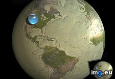
Pict. Rome. Basilica of Maxentius and Constantine (Basilica Nova) - north side, with maps of the Roman Empire (1919-1938).3208 (#North #Rome #Maps #Basilica #Constantine #Maxentius)Pict. 799×748 px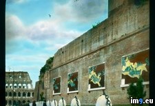 Pict. mapporn-all-the-water-on-earth-presented-as-a-sphere-it-would-have-a-diameter-of-about-860-miles-and-a-volume-around-332-500-000-cubic-miles-1600-1534 (#White #World #Map #Best #Europe #Water #Miles #Geography #Statistics #Presented #Diameter #Sphere #Cubic)Pict. 950×911 px
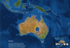
 Pict. mapporn-what-australia-and-surrounding-territories-would-look-like-if-all-the-ice-on-earth-were-to-melt-australia-1-024px-766px (#White #Map #Best #Wide #Europe #Ice #Asia #Territories #Melt #Stats #Surrounding #Statistics)Pict. 1024×766 px
 Pict. [Pics] My mate does incredible portraits on maps 2 (#Incredible #Maps #Portraits #Mate)Pict. 500×782 px
![[Pics] My mate does incredible portraits on maps 2 (#Incredible #Maps #Portraits #Mate) - 139 KB Tags: incredible, maps, mate, portraits (Pict. in My r/PICS favs)](https://t.im9.eu/pics-my-mate-does-incredible-portraits-on-maps-2.jpg) Pict. [Pics] My mate does incredible portraits on maps 7 (#Incredible #Maps #Portraits #Mate)Pict. 700×913 px
Pict. [Pics] My mate does incredible portraits on maps 7 (#Incredible #Maps #Portraits #Mate)Pict. 700×913 px![[Pics] My mate does incredible portraits on maps 7 (#Incredible #Maps #Portraits #Mate) - 191 KB Tags: incredible, maps, mate, portraits (Pict. in My r/PICS favs)](https://t.im9.eu/pics-my-mate-does-incredible-portraits-on-maps-7.jpg) Pict. mapporn-the-island-of-madagascar-compared-to-alaska-543-524 (#White #World #Map #Wide #Europe #Maps #Asia #Compared #Geography #Stats #Madagascar)Pict. 543×524 px
Pict. mapporn-the-island-of-madagascar-compared-to-alaska-543-524 (#White #World #Map #Wide #Europe #Maps #Asia #Compared #Geography #Stats #Madagascar)Pict. 543×524 px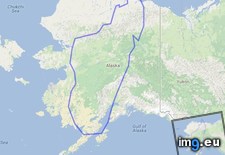 Pict. [Pics] My mate does incredible portraits on maps 1 (#Incredible #Maps #Portraits #Mate)Pict. 755×1196 px
![[Pics] My mate does incredible portraits on maps 1 (#Incredible #Maps #Portraits #Mate) - 270 KB Tags: incredible, maps, mate, portraits (Pict. in My r/PICS favs)](https://t.im9.eu/pics-my-mate-does-incredible-portraits-on-maps-1.jpg) Pict. [Pics] My mate does incredible portraits on maps 6 (#Incredible #Maps #Portraits #Mate)Pict. 700×725 px
Pict. [Pics] My mate does incredible portraits on maps 6 (#Incredible #Maps #Portraits #Mate)Pict. 700×725 px![[Pics] My mate does incredible portraits on maps 6 (#Incredible #Maps #Portraits #Mate) - 185 KB Tags: incredible, maps, mate, portraits (Pict. in My r/PICS favs)](https://t.im9.eu/pics-my-mate-does-incredible-portraits-on-maps-6.jpg) Pict. [Pics] My mate does incredible portraits on maps 4 (#Incredible #Maps #Portraits #Mate)Pict. 700×700 px
Pict. [Pics] My mate does incredible portraits on maps 4 (#Incredible #Maps #Portraits #Mate)Pict. 700×700 px![[Pics] My mate does incredible portraits on maps 4 (#Incredible #Maps #Portraits #Mate) - 147 KB Tags: incredible, maps, mate, portraits (Pict. in My r/PICS favs)](https://t.im9.eu/pics-my-mate-does-incredible-portraits-on-maps-4.jpg) Pict. [Pics] My mate does incredible portraits on maps 5 (#Incredible #Maps #Portraits #Mate)Pict. 700×967 px
Pict. [Pics] My mate does incredible portraits on maps 5 (#Incredible #Maps #Portraits #Mate)Pict. 700×967 px![[Pics] My mate does incredible portraits on maps 5 (#Incredible #Maps #Portraits #Mate) - 232 KB Tags: incredible, maps, mate, portraits (Pict. in My r/PICS favs)](https://t.im9.eu/pics-my-mate-does-incredible-portraits-on-maps-5.jpg) Pict. [Mapporn] Hand crafted topographical map of Banks Peninsula, New Zealand (Contour lines are at 100m intervals. More maps in comm (#New #Map #Are #Hand #Lines #Comm #Contour #Crafted #Intervals)Pict. 960×720 px
Pict. [Mapporn] Hand crafted topographical map of Banks Peninsula, New Zealand (Contour lines are at 100m intervals. More maps in comm (#New #Map #Are #Hand #Lines #Comm #Contour #Crafted #Intervals)Pict. 960×720 px![[Mapporn] Hand crafted topographical map of Banks Peninsula, New Zealand (Contour lines are at 100m intervals. More maps in comm (#New #Map #Are #Hand #Lines #Comm #Contour #Crafted #Intervals) - 137 KB Tags: are, banks, comm, contour, crafted, hand, intervals, lines, map, maps, new, peninsula, topographical, zealand (Pict. in My r/MAPS favs)](https://t.im9.eu/mapporn-hand-crafted-topographical-map-of-banks-peninsula-new-zealand-contour-lines-are-at-100m-intervals-more-maps-in-comments-oc-960x720.jpg) Pict. [Pics] My mate does incredible portraits on maps 3 (#Incredible #Maps #Portraits #Mate)Pict. 700×762 px
Pict. [Pics] My mate does incredible portraits on maps 3 (#Incredible #Maps #Portraits #Mate)Pict. 700×762 px![[Pics] My mate does incredible portraits on maps 3 (#Incredible #Maps #Portraits #Mate) - 194 KB Tags: incredible, maps, mate, portraits (Pict. in My r/PICS favs)](https://t.im9.eu/pics-my-mate-does-incredible-portraits-on-maps-3.jpg) Pict. [Pics] Every book should have its maps set up like this (#Book #Maps )Pict. 653×736 px
Pict. [Pics] Every book should have its maps set up like this (#Book #Maps )Pict. 653×736 px![[Pics] Every book should have its maps set up like this (#Book #Maps ) - 63 KB Tags: book, maps (Pict. in My r/PICS favs)](https://t.im9.eu/pics-every-book-should-have-its-maps-set-up-like-this.jpg) Pict. [Mapporn] Composite map of England in 1900 made with 360 seperate maps. (Extremely high resolution zoomable source in comments, (#High #Source #Map #Extremely #Composite #Zoomable #Seperate)Pict. 5786×6600 px
Pict. [Mapporn] Composite map of England in 1900 made with 360 seperate maps. (Extremely high resolution zoomable source in comments, (#High #Source #Map #Extremely #Composite #Zoomable #Seperate)Pict. 5786×6600 px![[Mapporn] Composite map of England in 1900 made with 360 seperate maps. (Extremely high resolution zoomable source in comments, (#High #Source #Map #Extremely #Composite #Zoomable #Seperate) - 4.3 MB Tags: composite, england, extremely, high, map, maps, resolution, seperate, source, zoomable (Pict. in My r/MAPS favs)](https://t.im9.eu/mapporn-composite-map-of-england-in-1900-made-with-360-seperate-maps-extremely-high-resolution-zoomable-source-in-comments-also-versions-for-germany-in-1893-france-in-1750-london-in-1896-and-england-in-1947-in-comments-5786x6600.jpg) Pict. [Mapporn] Two maps: [left] Results of the 1918 General Election which led to the Irish War of Independence, [right] the modern U (#Two #Left #General #War #Independence #Irish #Led)Pict. 1860×996 px
Pict. [Mapporn] Two maps: [left] Results of the 1918 General Election which led to the Irish War of Independence, [right] the modern U (#Two #Left #General #War #Independence #Irish #Led)Pict. 1860×996 px![[Mapporn] Two maps: [left] Results of the 1918 General Election which led to the Irish War of Independence, [right] the modern U (#Two #Left #General #War #Independence #Irish #Led) - 245 KB Tags: election, general, independence, irish, led, left, maps, modern, results, two, war (Pict. in My r/MAPS favs)](https://t.im9.eu/mapporn-two-maps-left-results-of-the-1918-general-election-which-led-to-the-irish-war-of-independence-right-the-modern-uk-ireland-border-1860x996.jpg) Pict. [Mapporn] History of World War II, a 3-sheet map published in the San Francisco Examiner in 1945. (Individual Hi-Res Maps in Com (#Res #World #Map #Com #Maps #Sheet #Published #Individual)Pict. 5891×2663 px
Pict. [Mapporn] History of World War II, a 3-sheet map published in the San Francisco Examiner in 1945. (Individual Hi-Res Maps in Com (#Res #World #Map #Com #Maps #Sheet #Published #Individual)Pict. 5891×2663 px![[Mapporn] History of World War II, a 3-sheet map published in the San Francisco Examiner in 1945. (Individual Hi-Res Maps in Com (#Res #World #Map #Com #Maps #Sheet #Published #Individual) - 4.4 MB Tags: com, francisco, history, individual, map, maps, published, res, san, sheet, war, world (Pict. in My r/MAPS favs)](https://t.im9.eu/mapporn-history-of-world-war-ii-a-3-sheet-map-published-in-the-san-francisco-examiner-in-1945-individual-hi-res-maps-in-comments-5891x2663.jpg) Pict. [Mapporn] Three Approaches to the U.S.: WW-II era tilted perspective maps from viewpoints above Berlin, Tokyo, and Caracas. [161 (#Maps #Tokyo #Berlin #Tilted #Caracas #Viewpoints)Pict. 1617×2074 px
Pict. [Mapporn] Three Approaches to the U.S.: WW-II era tilted perspective maps from viewpoints above Berlin, Tokyo, and Caracas. [161 (#Maps #Tokyo #Berlin #Tilted #Caracas #Viewpoints)Pict. 1617×2074 px![[Mapporn] Three Approaches to the U.S.: WW-II era tilted perspective maps from viewpoints above Berlin, Tokyo, and Caracas. [161 (#Maps #Tokyo #Berlin #Tilted #Caracas #Viewpoints) - 604 KB Tags: approaches, berlin, caracas, era, maps, perspective, tilted, tokyo, viewpoints (Pict. in My r/MAPS favs)](https://t.im9.eu/mapporn-three-approaches-to-the-u-s-ww-ii-era-tilted-perspective-maps-from-viewpoints-above-berlin-tokyo-and-caracas-1617-2074.jpg) Pict. [Mapporn] [OC] Presidents of the EU Institutions by Member State of Origin (link to maps of six individual institutions in comme (#State #Maps #Six #Presidents #Comme #Institutions)Pict. 1360×1245 px
Pict. [Mapporn] [OC] Presidents of the EU Institutions by Member State of Origin (link to maps of six individual institutions in comme (#State #Maps #Six #Presidents #Comme #Institutions)Pict. 1360×1245 px![[Mapporn] [OC] Presidents of the EU Institutions by Member State of Origin (link to maps of six individual institutions in comme (#State #Maps #Six #Presidents #Comme #Institutions) - 194 KB Tags: comme, individual, institutions, maps, member, origin, presidents, six, state (Pict. in My r/MAPS favs)](https://t.im9.eu/mapporn-oc-presidents-of-the-eu-institutions-by-member-state-of-origin-link-to-maps-of-six-individual-institutions-in-comments-1360x1245.jpg) Pict. mapporn-some-of-the-most-hazardous-places-in-the-world-838-612 (#World #Map #Wide #Usa #Asia #Geography #Statistics)Pict. 838×612 px
Pict. mapporn-some-of-the-most-hazardous-places-in-the-world-838-612 (#World #Map #Wide #Usa #Asia #Geography #Statistics)Pict. 838×612 px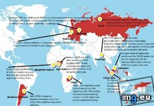 Pict. [Mapporn] We've all seen maps of landlocked countries...here's a map of landlocked first level administrative divisions [4972x25 (#Map #Countries #Divisions #Administrative #Landlocked)Pict. 4972×2517 px
![[Mapporn] We've all seen maps of landlocked countries...here's a map of landlocked first level administrative divisions [4972x25 (#Map #Countries #Divisions #Administrative #Landlocked) - 261 KB Tags: administrative, countries, divisions, landlocked, level, map, maps (Pict. in My r/MAPS favs)](https://t.im9.eu/mapporn-we-ve-all-seen-maps-of-landlocked-countries-here-s-a-map-of-landlocked-first-level-administrative-divisions-4972x2517.jpg) Pict. mapporn-the-chinese-world-7th-8th-centuries-1-253-923 (#World #White #Map #Best #Average #Maps #Asia #Centuries)Pict. 1253×923 px
Pict. mapporn-the-chinese-world-7th-8th-centuries-1-253-923 (#World #White #Map #Best #Average #Maps #Asia #Centuries)Pict. 1253×923 px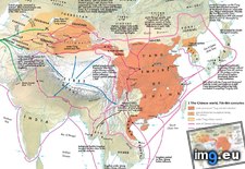 Pict. [Mapporn] I used this infrared satellite photo of the Netherlands as a wall decoration. Do any more people here use maps as a fo (#Photo #People #Wall #Decoration #Infrared)Pict. 2448×3264 px
![[Mapporn] I used this infrared satellite photo of the Netherlands as a wall decoration. Do any more people here use maps as a fo (#Photo #People #Wall #Decoration #Infrared) - 688 KB Tags: decoration, infrared, maps, netherlands, people, photo, satellite, wall (Pict. in My r/MAPS favs)](https://t.im9.eu/mapporn-i-used-this-infrared-satellite-photo-of-the-netherlands-as-a-wall-decoration-do-any-more-people-here-use-maps-as-a-form-of-decoration-2448x3264.jpg) Pict. [Mapporn] [1380x1206] I Make Artistic Maps For Civilization V. This One Is An Updated Map For Spain Under Isabella. (#One #Map #Updated #Isabella #Civilization)Pict. 1206×1380 px
Pict. [Mapporn] [1380x1206] I Make Artistic Maps For Civilization V. This One Is An Updated Map For Spain Under Isabella. (#One #Map #Updated #Isabella #Civilization)Pict. 1206×1380 px![[Mapporn] [1380x1206] I Make Artistic Maps For Civilization V. This One Is An Updated Map For Spain Under Isabella. (#One #Map #Updated #Isabella #Civilization) - 383 KB Tags: artistic, civilization, isabella, map, maps, one, spain, updated (Pict. in My r/MAPS favs)](https://t.im9.eu/mapporn-1380x1206-i-make-artistic-maps-for-civilization-v-this-one-is-an-updated-map-for-spain-under-isabella.jpg) Pict. [Mapporn] Protest Maps and the Power of Cartography, ”‘Citywide pattern of children’s pedestrian deaths and injuries by automobi (#Power #Children #Maps #Injuries #Pedestrian)Pict. 1001×1166 px
Pict. [Mapporn] Protest Maps and the Power of Cartography, ”‘Citywide pattern of children’s pedestrian deaths and injuries by automobi (#Power #Children #Maps #Injuries #Pedestrian)Pict. 1001×1166 px![[Mapporn] Protest Maps and the Power of Cartography, ”‘Citywide pattern of children’s pedestrian deaths and injuries by automobi (#Power #Children #Maps #Injuries #Pedestrian) - 264 KB Tags: children, deaths, injuries, maps, pattern, pedestrian, power, protest (Pict. in My r/MAPS favs)](https://t.im9.eu/mapporn-protest-maps-and-the-power-of-cartography-citywide-pattern-of-children-s-pedestrian-deaths-and-injuries-by-automobiles-or-where-commuters-run-over-black-children-on-the-pointesdowntown-track-article-in-comments-1001x1166.jpg)
★ 11k pts. ♥ 0 likes ⬇ 6 saves
 Pict. mapporn-all-the-water-on-earth-presented-as-a-sphere-it-would-have-a-diameter-of-about-860-miles-and-a-volume-around-332-500-000-cubic-miles-1600-1534 (#White #World #Map #Best #Europe #Water #Miles #Geography #Statistics #Presented #Diameter #Sphere #Cubic)Pict. 950×911 px
★ 10k pts. ♥ 0 likes ⬇ 5 saves
 Pict. mapporn-what-australia-and-surrounding-territories-would-look-like-if-all-the-ice-on-earth-were-to-melt-australia-1-024px-766px (#White #Map #Best #Wide #Europe #Ice #Asia #Territories #Melt #Stats #Surrounding #Statistics)Pict. 1024×766 px
★ 9848 pts. ♥ 0 likes ⬇ 8 saves
 Pict. [Pics] My mate does incredible portraits on maps 2 (#Incredible #Maps #Portraits #Mate)Pict. 500×782 px
★ 9251 pts. ♥ 0 likes ⬇ 9 saves
![[Pics] My mate does incredible portraits on maps 2 (#Incredible #Maps #Portraits #Mate) - 139 KB Tags: incredible, maps, mate, portraits (Pict. in My r/PICS favs)](https://t.im9.eu/pics-my-mate-does-incredible-portraits-on-maps-2.jpg) Pict. [Pics] My mate does incredible portraits on maps 7 (#Incredible #Maps #Portraits #Mate)Pict. 700×913 px
Pict. [Pics] My mate does incredible portraits on maps 7 (#Incredible #Maps #Portraits #Mate)Pict. 700×913 px★ 9243 pts. ♥ 0 likes ⬇ 7 saves
![[Pics] My mate does incredible portraits on maps 7 (#Incredible #Maps #Portraits #Mate) - 191 KB Tags: incredible, maps, mate, portraits (Pict. in My r/PICS favs)](https://t.im9.eu/pics-my-mate-does-incredible-portraits-on-maps-7.jpg) Pict. mapporn-the-island-of-madagascar-compared-to-alaska-543-524 (#White #World #Map #Wide #Europe #Maps #Asia #Compared #Geography #Stats #Madagascar)Pict. 543×524 px
Pict. mapporn-the-island-of-madagascar-compared-to-alaska-543-524 (#White #World #Map #Wide #Europe #Maps #Asia #Compared #Geography #Stats #Madagascar)Pict. 543×524 px★ 9126 pts. ♥ 0 likes ⬇ 6 saves
 Pict. [Pics] My mate does incredible portraits on maps 1 (#Incredible #Maps #Portraits #Mate)Pict. 755×1196 px
★ 9124 pts. ♥ 0 likes ⬇ 6 saves
![[Pics] My mate does incredible portraits on maps 1 (#Incredible #Maps #Portraits #Mate) - 270 KB Tags: incredible, maps, mate, portraits (Pict. in My r/PICS favs)](https://t.im9.eu/pics-my-mate-does-incredible-portraits-on-maps-1.jpg) Pict. [Pics] My mate does incredible portraits on maps 6 (#Incredible #Maps #Portraits #Mate)Pict. 700×725 px
Pict. [Pics] My mate does incredible portraits on maps 6 (#Incredible #Maps #Portraits #Mate)Pict. 700×725 px★ 9059 pts. ♥ 0 likes ⬇ 3 saves
![[Pics] My mate does incredible portraits on maps 6 (#Incredible #Maps #Portraits #Mate) - 185 KB Tags: incredible, maps, mate, portraits (Pict. in My r/PICS favs)](https://t.im9.eu/pics-my-mate-does-incredible-portraits-on-maps-6.jpg) Pict. [Pics] My mate does incredible portraits on maps 4 (#Incredible #Maps #Portraits #Mate)Pict. 700×700 px
Pict. [Pics] My mate does incredible portraits on maps 4 (#Incredible #Maps #Portraits #Mate)Pict. 700×700 px★ 9048 pts. ♥ 0 likes ⬇ 3 saves
![[Pics] My mate does incredible portraits on maps 4 (#Incredible #Maps #Portraits #Mate) - 147 KB Tags: incredible, maps, mate, portraits (Pict. in My r/PICS favs)](https://t.im9.eu/pics-my-mate-does-incredible-portraits-on-maps-4.jpg) Pict. [Pics] My mate does incredible portraits on maps 5 (#Incredible #Maps #Portraits #Mate)Pict. 700×967 px
Pict. [Pics] My mate does incredible portraits on maps 5 (#Incredible #Maps #Portraits #Mate)Pict. 700×967 px★ 9042 pts. ♥ 0 likes ⬇ 4 saves
![[Pics] My mate does incredible portraits on maps 5 (#Incredible #Maps #Portraits #Mate) - 232 KB Tags: incredible, maps, mate, portraits (Pict. in My r/PICS favs)](https://t.im9.eu/pics-my-mate-does-incredible-portraits-on-maps-5.jpg) Pict. [Mapporn] Hand crafted topographical map of Banks Peninsula, New Zealand (Contour lines are at 100m intervals. More maps in comm (#New #Map #Are #Hand #Lines #Comm #Contour #Crafted #Intervals)Pict. 960×720 px
Pict. [Mapporn] Hand crafted topographical map of Banks Peninsula, New Zealand (Contour lines are at 100m intervals. More maps in comm (#New #Map #Are #Hand #Lines #Comm #Contour #Crafted #Intervals)Pict. 960×720 px★ 8986 pts. ♥ 0 likes ⬇ 20 saves
![[Mapporn] Hand crafted topographical map of Banks Peninsula, New Zealand (Contour lines are at 100m intervals. More maps in comm (#New #Map #Are #Hand #Lines #Comm #Contour #Crafted #Intervals) - 137 KB Tags: are, banks, comm, contour, crafted, hand, intervals, lines, map, maps, new, peninsula, topographical, zealand (Pict. in My r/MAPS favs)](https://t.im9.eu/mapporn-hand-crafted-topographical-map-of-banks-peninsula-new-zealand-contour-lines-are-at-100m-intervals-more-maps-in-comments-oc-960x720.jpg) Pict. [Pics] My mate does incredible portraits on maps 3 (#Incredible #Maps #Portraits #Mate)Pict. 700×762 px
Pict. [Pics] My mate does incredible portraits on maps 3 (#Incredible #Maps #Portraits #Mate)Pict. 700×762 px★ 8894 pts. ♥ 0 likes ⬇ 2 saves
![[Pics] My mate does incredible portraits on maps 3 (#Incredible #Maps #Portraits #Mate) - 194 KB Tags: incredible, maps, mate, portraits (Pict. in My r/PICS favs)](https://t.im9.eu/pics-my-mate-does-incredible-portraits-on-maps-3.jpg) Pict. [Pics] Every book should have its maps set up like this (#Book #Maps )Pict. 653×736 px
Pict. [Pics] Every book should have its maps set up like this (#Book #Maps )Pict. 653×736 px★ 8228 pts. ♥ 0 likes ⬇ 6 saves
![[Pics] Every book should have its maps set up like this (#Book #Maps ) - 63 KB Tags: book, maps (Pict. in My r/PICS favs)](https://t.im9.eu/pics-every-book-should-have-its-maps-set-up-like-this.jpg) Pict. [Mapporn] Composite map of England in 1900 made with 360 seperate maps. (Extremely high resolution zoomable source in comments, (#High #Source #Map #Extremely #Composite #Zoomable #Seperate)Pict. 5786×6600 px
Pict. [Mapporn] Composite map of England in 1900 made with 360 seperate maps. (Extremely high resolution zoomable source in comments, (#High #Source #Map #Extremely #Composite #Zoomable #Seperate)Pict. 5786×6600 px★ 7903 pts. ♥ 0 likes ⬇ 7 saves
![[Mapporn] Composite map of England in 1900 made with 360 seperate maps. (Extremely high resolution zoomable source in comments, (#High #Source #Map #Extremely #Composite #Zoomable #Seperate) - 4.3 MB Tags: composite, england, extremely, high, map, maps, resolution, seperate, source, zoomable (Pict. in My r/MAPS favs)](https://t.im9.eu/mapporn-composite-map-of-england-in-1900-made-with-360-seperate-maps-extremely-high-resolution-zoomable-source-in-comments-also-versions-for-germany-in-1893-france-in-1750-london-in-1896-and-england-in-1947-in-comments-5786x6600.jpg) Pict. [Mapporn] Two maps: [left] Results of the 1918 General Election which led to the Irish War of Independence, [right] the modern U (#Two #Left #General #War #Independence #Irish #Led)Pict. 1860×996 px
Pict. [Mapporn] Two maps: [left] Results of the 1918 General Election which led to the Irish War of Independence, [right] the modern U (#Two #Left #General #War #Independence #Irish #Led)Pict. 1860×996 px★ 7872 pts. ♥ 0 likes ⬇ 8 saves
![[Mapporn] Two maps: [left] Results of the 1918 General Election which led to the Irish War of Independence, [right] the modern U (#Two #Left #General #War #Independence #Irish #Led) - 245 KB Tags: election, general, independence, irish, led, left, maps, modern, results, two, war (Pict. in My r/MAPS favs)](https://t.im9.eu/mapporn-two-maps-left-results-of-the-1918-general-election-which-led-to-the-irish-war-of-independence-right-the-modern-uk-ireland-border-1860x996.jpg) Pict. [Mapporn] History of World War II, a 3-sheet map published in the San Francisco Examiner in 1945. (Individual Hi-Res Maps in Com (#Res #World #Map #Com #Maps #Sheet #Published #Individual)Pict. 5891×2663 px
Pict. [Mapporn] History of World War II, a 3-sheet map published in the San Francisco Examiner in 1945. (Individual Hi-Res Maps in Com (#Res #World #Map #Com #Maps #Sheet #Published #Individual)Pict. 5891×2663 px★ 7870 pts. ♥ 0 likes ⬇ 10 saves
![[Mapporn] History of World War II, a 3-sheet map published in the San Francisco Examiner in 1945. (Individual Hi-Res Maps in Com (#Res #World #Map #Com #Maps #Sheet #Published #Individual) - 4.4 MB Tags: com, francisco, history, individual, map, maps, published, res, san, sheet, war, world (Pict. in My r/MAPS favs)](https://t.im9.eu/mapporn-history-of-world-war-ii-a-3-sheet-map-published-in-the-san-francisco-examiner-in-1945-individual-hi-res-maps-in-comments-5891x2663.jpg) Pict. [Mapporn] Three Approaches to the U.S.: WW-II era tilted perspective maps from viewpoints above Berlin, Tokyo, and Caracas. [161 (#Maps #Tokyo #Berlin #Tilted #Caracas #Viewpoints)Pict. 1617×2074 px
Pict. [Mapporn] Three Approaches to the U.S.: WW-II era tilted perspective maps from viewpoints above Berlin, Tokyo, and Caracas. [161 (#Maps #Tokyo #Berlin #Tilted #Caracas #Viewpoints)Pict. 1617×2074 px★ 7384 pts. ♥ 0 likes ⬇ 6 saves
![[Mapporn] Three Approaches to the U.S.: WW-II era tilted perspective maps from viewpoints above Berlin, Tokyo, and Caracas. [161 (#Maps #Tokyo #Berlin #Tilted #Caracas #Viewpoints) - 604 KB Tags: approaches, berlin, caracas, era, maps, perspective, tilted, tokyo, viewpoints (Pict. in My r/MAPS favs)](https://t.im9.eu/mapporn-three-approaches-to-the-u-s-ww-ii-era-tilted-perspective-maps-from-viewpoints-above-berlin-tokyo-and-caracas-1617-2074.jpg) Pict. [Mapporn] [OC] Presidents of the EU Institutions by Member State of Origin (link to maps of six individual institutions in comme (#State #Maps #Six #Presidents #Comme #Institutions)Pict. 1360×1245 px
Pict. [Mapporn] [OC] Presidents of the EU Institutions by Member State of Origin (link to maps of six individual institutions in comme (#State #Maps #Six #Presidents #Comme #Institutions)Pict. 1360×1245 px★ 7186 pts. ♥ 0 likes ⬇ 13 saves
![[Mapporn] [OC] Presidents of the EU Institutions by Member State of Origin (link to maps of six individual institutions in comme (#State #Maps #Six #Presidents #Comme #Institutions) - 194 KB Tags: comme, individual, institutions, maps, member, origin, presidents, six, state (Pict. in My r/MAPS favs)](https://t.im9.eu/mapporn-oc-presidents-of-the-eu-institutions-by-member-state-of-origin-link-to-maps-of-six-individual-institutions-in-comments-1360x1245.jpg) Pict. mapporn-some-of-the-most-hazardous-places-in-the-world-838-612 (#World #Map #Wide #Usa #Asia #Geography #Statistics)Pict. 838×612 px
Pict. mapporn-some-of-the-most-hazardous-places-in-the-world-838-612 (#World #Map #Wide #Usa #Asia #Geography #Statistics)Pict. 838×612 px★ 7173 pts. ♥ 0 likes ⬇ 4 saves
 Pict. [Mapporn] We've all seen maps of landlocked countries...here's a map of landlocked first level administrative divisions [4972x25 (#Map #Countries #Divisions #Administrative #Landlocked)Pict. 4972×2517 px
★ 7118 pts. ♥ 0 likes ⬇ 10 saves
![[Mapporn] We've all seen maps of landlocked countries...here's a map of landlocked first level administrative divisions [4972x25 (#Map #Countries #Divisions #Administrative #Landlocked) - 261 KB Tags: administrative, countries, divisions, landlocked, level, map, maps (Pict. in My r/MAPS favs)](https://t.im9.eu/mapporn-we-ve-all-seen-maps-of-landlocked-countries-here-s-a-map-of-landlocked-first-level-administrative-divisions-4972x2517.jpg) Pict. mapporn-the-chinese-world-7th-8th-centuries-1-253-923 (#World #White #Map #Best #Average #Maps #Asia #Centuries)Pict. 1253×923 px
Pict. mapporn-the-chinese-world-7th-8th-centuries-1-253-923 (#World #White #Map #Best #Average #Maps #Asia #Centuries)Pict. 1253×923 px★ 7065 pts. ♥ 0 likes ⬇ 2 saves
 Pict. [Mapporn] I used this infrared satellite photo of the Netherlands as a wall decoration. Do any more people here use maps as a fo (#Photo #People #Wall #Decoration #Infrared)Pict. 2448×3264 px
★ 7053 pts. ♥ 0 likes ⬇ 6 saves
![[Mapporn] I used this infrared satellite photo of the Netherlands as a wall decoration. Do any more people here use maps as a fo (#Photo #People #Wall #Decoration #Infrared) - 688 KB Tags: decoration, infrared, maps, netherlands, people, photo, satellite, wall (Pict. in My r/MAPS favs)](https://t.im9.eu/mapporn-i-used-this-infrared-satellite-photo-of-the-netherlands-as-a-wall-decoration-do-any-more-people-here-use-maps-as-a-form-of-decoration-2448x3264.jpg) Pict. [Mapporn] [1380x1206] I Make Artistic Maps For Civilization V. This One Is An Updated Map For Spain Under Isabella. (#One #Map #Updated #Isabella #Civilization)Pict. 1206×1380 px
Pict. [Mapporn] [1380x1206] I Make Artistic Maps For Civilization V. This One Is An Updated Map For Spain Under Isabella. (#One #Map #Updated #Isabella #Civilization)Pict. 1206×1380 px★ 6999 pts. ♥ 0 likes ⬇ 10 saves
![[Mapporn] [1380x1206] I Make Artistic Maps For Civilization V. This One Is An Updated Map For Spain Under Isabella. (#One #Map #Updated #Isabella #Civilization) - 383 KB Tags: artistic, civilization, isabella, map, maps, one, spain, updated (Pict. in My r/MAPS favs)](https://t.im9.eu/mapporn-1380x1206-i-make-artistic-maps-for-civilization-v-this-one-is-an-updated-map-for-spain-under-isabella.jpg) Pict. [Mapporn] Protest Maps and the Power of Cartography, ”‘Citywide pattern of children’s pedestrian deaths and injuries by automobi (#Power #Children #Maps #Injuries #Pedestrian)Pict. 1001×1166 px
Pict. [Mapporn] Protest Maps and the Power of Cartography, ”‘Citywide pattern of children’s pedestrian deaths and injuries by automobi (#Power #Children #Maps #Injuries #Pedestrian)Pict. 1001×1166 px★ 6943 pts. ♥ 0 likes ⬇ 6 saves
![[Mapporn] Protest Maps and the Power of Cartography, ”‘Citywide pattern of children’s pedestrian deaths and injuries by automobi (#Power #Children #Maps #Injuries #Pedestrian) - 264 KB Tags: children, deaths, injuries, maps, pattern, pedestrian, power, protest (Pict. in My r/MAPS favs)](https://t.im9.eu/mapporn-protest-maps-and-the-power-of-cartography-citywide-pattern-of-children-s-pedestrian-deaths-and-injuries-by-automobiles-or-where-commuters-run-over-black-children-on-the-pointesdowntown-track-article-in-comments-1001x1166.jpg)