★ 6435 pts. ♥ 0 likes ⬇ 9 saves
![[Mapporn] McArthur's Universal Corrective Map Of The World [1000x658] (#World #Map #Universal #Corrective) - 132 KB Tags: corrective, map, universal, world (Pict. in My r/MAPS favs)](https://t.im9.eu/mapporn-mcarthur-s-universal-corrective-map-of-the-world-1000x658.jpg) Pict. BlueOxen&map ( #Map)Pict. 377×229 px
Pict. BlueOxen&map ( #Map)Pict. 377×229 px★ 1609 pts. ♥ 0 likes ⬇ 15 saves
 Pict. [Mapporn] Irish Counties Photo Map [3504x4961] [OS] (#Photo #Map #Counties #Irish)Pict. 2453×3473 px
★ 5245 pts. ♥ 0 likes ⬇ 1 saves
![[Mapporn] Irish Counties Photo Map [3504x4961] [OS] (#Photo #Map #Counties #Irish) - 905 KB Tags: counties, irish, map, photo (Pict. in My r/MAPS favs)](https://t.im9.eu/mapporn-irish-counties-photo-map-3504x4961-os.jpg) Pict. [Mapporn] Map of European support for dictatorship and democracy [1023x1495] (#Map #European #Support #Democracy)Pict. 1023×1495 px
Pict. [Mapporn] Map of European support for dictatorship and democracy [1023x1495] (#Map #European #Support #Democracy)Pict. 1023×1495 px★ 5858 pts. ♥ 0 likes ⬇ 6 saves
![[Mapporn] Map of European support for dictatorship and democracy [1023x1495] (#Map #European #Support #Democracy) - 232 KB Tags: democracy, european, map, support (Pict. in My r/MAPS favs)](https://t.im9.eu/mapporn-map-of-european-support-for-dictatorship-and-democracy-1023x1495.jpg) Pict. [Mapporn] A Map showing the de facto situation of the world as it was on July 24th of this year.[1204x650] (#Year #World #Map #Showing #Situation #Facto)Pict. 1204×650 px
Pict. [Mapporn] A Map showing the de facto situation of the world as it was on July 24th of this year.[1204x650] (#Year #World #Map #Showing #Situation #Facto)Pict. 1204×650 px★ 6451 pts. ♥ 0 likes ⬇ 8 saves
![[Mapporn] A Map showing the de facto situation of the world as it was on July 24th of this year.[1204x650] (#Year #World #Map #Showing #Situation #Facto) - 178 KB Tags: facto, map, showing, situation, world, year (Pict. in My r/MAPS favs)](https://t.im9.eu/mapporn-a-map-showing-the-de-facto-situation-of-the-world-as-it-was-on-july-24th-of-this-year-1204x650.jpg) Pict. [Mapporn] 'Angling in Troubled Waters': a 'serio-comic' map of Europe by Fred W. Rose, 1899 (more in comments) [2279x1639] (#Map #Europe #Rose #Troubled #Serio #Angling)Pict. 2279×1639 px
Pict. [Mapporn] 'Angling in Troubled Waters': a 'serio-comic' map of Europe by Fred W. Rose, 1899 (more in comments) [2279x1639] (#Map #Europe #Rose #Troubled #Serio #Angling)Pict. 2279×1639 px★ 7142 pts. ♥ 0 likes ⬇ 17 saves
![[Mapporn] 'Angling in Troubled Waters': a 'serio-comic' map of Europe by Fred W. Rose, 1899 (more in comments) [2279x1639] (#Map #Europe #Rose #Troubled #Serio #Angling) - 618 KB Tags: angling, comic, europe, fred, map, rose, serio, troubled, waters (Pict. in My r/MAPS favs)](https://t.im9.eu/mapporn-angling-in-troubled-waters-a-serio-comic-map-of-europe-by-fred-w-rose-1899-more-in-comments-2279x1639.jpg) Pict. Dove&map ( #Map)Pict. 386×225 px
Pict. Dove&map ( #Map)Pict. 386×225 px★ 1369 pts. ♥ 0 likes ⬇ 5 saves
 Pict. Dragon&map (#Map #Dragon )Pict. 407×242 px
★ 1833 pts. ♥ 0 likes ⬇ 18 saves
 Pict. [Mapporn] Cantino Map 1502 [2789x1298] ( #Map)Pict. 2789×1298 px
★ 3989 pts. ♥ 0 likes ⬇ 1 saves
![[Mapporn] Cantino Map 1502 [2789x1298] ( #Map) - 890 KB Tags: map (Pict. in My r/MAPS favs)](https://t.im9.eu/mapporn-cantino-map-1502-2789x1298.jpg) Pict. [Mapporn] Oldest known map of Switzerland shares ironic similarity with the Situation today. [760x818] (#Map #Shares #Switzerland #Situation #Oldest #Similarity)Pict. 760×818 px
Pict. [Mapporn] Oldest known map of Switzerland shares ironic similarity with the Situation today. [760x818] (#Map #Shares #Switzerland #Situation #Oldest #Similarity)Pict. 760×818 px★ 6692 pts. ♥ 0 likes ⬇ 4 saves
![[Mapporn] Oldest known map of Switzerland shares ironic similarity with the Situation today. [760x818] (#Map #Shares #Switzerland #Situation #Oldest #Similarity) - 147 KB Tags: map, oldest, shares, similarity, situation, switzerland (Pict. in My r/MAPS favs)](https://t.im9.eu/mapporn-oldest-known-map-of-switzerland-shares-ironic-similarity-with-the-situation-today-760x818.jpg) Pict. [Mapporn] Civil War Map of New Orleans overlaid on a modern shaded elevation map. [OCish][1448x1571] (#Map #War #Elevation #Orleans #Overlaid)Pict. 1448×1571 px
Pict. [Mapporn] Civil War Map of New Orleans overlaid on a modern shaded elevation map. [OCish][1448x1571] (#Map #War #Elevation #Orleans #Overlaid)Pict. 1448×1571 px★ 6220 pts. ♥ 0 likes ⬇ 3 saves
![[Mapporn] Civil War Map of New Orleans overlaid on a modern shaded elevation map. [OCish][1448x1571] (#Map #War #Elevation #Orleans #Overlaid) - 483 KB Tags: civil, elevation, map, modern, orleans, overlaid, war (Pict. in My r/MAPS favs)](https://t.im9.eu/mapporn-civil-war-map-of-new-orleans-overlaid-on-a-modern-shaded-elevation-map-ocish-1448x1571.jpg) Pict. [Mapporn] Subjective Map of Delaware [1333x943] (#Map #Delaware )Pict. 1333×943 px
Pict. [Mapporn] Subjective Map of Delaware [1333x943] (#Map #Delaware )Pict. 1333×943 px★ 4750 pts. ♥ 0 likes ⬇ 10 saves
![[Mapporn] Subjective Map of Delaware [1333x943] (#Map #Delaware ) - 192 KB Tags: delaware, map (Pict. in My r/MAPS favs)](https://t.im9.eu/mapporn-subjective-map-of-delaware-1333x943.jpg) Pict. [Mapporn] 1987 Halton-Peel, Ontario 'Tapestry' map (4000X2800). Poor scan-stitch. (#Map #Ontario #Peel #Stitch #Tapestry)Pict. 4000×2803 px
Pict. [Mapporn] 1987 Halton-Peel, Ontario 'Tapestry' map (4000X2800). Poor scan-stitch. (#Map #Ontario #Peel #Stitch #Tapestry)Pict. 4000×2803 px★ 5936 pts. ♥ 0 likes ⬇ 2 saves
![[Mapporn] 1987 Halton-Peel, Ontario 'Tapestry' map (4000X2800). Poor scan-stitch. (#Map #Ontario #Peel #Stitch #Tapestry) - 1.9 MB Tags: map, ontario, peel, poor, scan, stitch, tapestry (Pict. in My r/MAPS favs)](https://t.im9.eu/mapporn-1987-halton-peel-ontario-tapestry-map-4000x2800-poor-scan-stitch.jpg) Pict. [Mapporn] Serio-Comic War Map for the Year 1877 [1,024 x 783] (#Year #Map #War #Comic #Serio)Pict. 1024×783 px
Pict. [Mapporn] Serio-Comic War Map for the Year 1877 [1,024 x 783] (#Year #Map #War #Comic #Serio)Pict. 1024×783 px★ 5365 pts. ♥ 0 likes ⬇ 10 saves
![[Mapporn] Serio-Comic War Map for the Year 1877 [1,024 x 783] (#Year #Map #War #Comic #Serio) - 261 KB Tags: comic, map, serio, war, year (Pict. in My r/MAPS favs)](https://t.im9.eu/mapporn-serio-comic-war-map-for-the-year-1877-1-024-x-783.jpg) Pict. [Mapporn] Topographic hillshade map of France [2370x2784] (#Map #France #Topographic)Pict. 2370×2784 px
Pict. [Mapporn] Topographic hillshade map of France [2370x2784] (#Map #France #Topographic)Pict. 2370×2784 px★ 5017 pts. ♥ 0 likes ⬇ 4 saves
![[Mapporn] Topographic hillshade map of France [2370x2784] (#Map #France #Topographic) - 1.2 MB Tags: france, map, topographic (Pict. in My r/MAPS favs)](https://t.im9.eu/mapporn-topographic-hillshade-map-of-france-2370x2784.jpg) Pict. [Mapporn] Japanese World Map from the Board Game 'Conquering the Skies'. Made in 1930 [5291x3834] (#Japanese #Game #Board #Skies #Conquering)Pict. 5291×3834 px
Pict. [Mapporn] Japanese World Map from the Board Game 'Conquering the Skies'. Made in 1930 [5291x3834] (#Japanese #Game #Board #Skies #Conquering)Pict. 5291×3834 px★ 6500 pts. ♥ 0 likes ⬇ 9 saves
![[Mapporn] Japanese World Map from the Board Game 'Conquering the Skies'. Made in 1930 [5291x3834] (#Japanese #Game #Board #Skies #Conquering) - 3.8 MB Tags: board, conquering, game, japanese, map, skies, world (Pict. in My r/MAPS favs)](https://t.im9.eu/mapporn-japanese-world-map-from-the-board-game-conquering-the-skies-made-in-1930-5291x3834.jpg) Pict. [Mapporn] [Repost] An incredibly detailed map of the Roman Empire in 211 CE. [4707x3333] (#Map #Repost #Empire #Roman #Incredibly #Detailed)Pict. 4707×3333 px
Pict. [Mapporn] [Repost] An incredibly detailed map of the Roman Empire in 211 CE. [4707x3333] (#Map #Repost #Empire #Roman #Incredibly #Detailed)Pict. 4707×3333 px★ 6033 pts. ♥ 0 likes ⬇ 12 saves
![[Mapporn] [Repost] An incredibly detailed map of the Roman Empire in 211 CE. [4707x3333] (#Map #Repost #Empire #Roman #Incredibly #Detailed) - 2.9 MB Tags: detailed, empire, incredibly, map, repost, roman (Pict. in My r/MAPS favs)](https://t.im9.eu/mapporn-repost-an-incredibly-detailed-map-of-the-roman-empire-in-211-ce-4707x3333.jpg) Pict. [Mildlyinteresting] Autocomplete United States (inspired by The Autocomplete Map of Canada posted by -u-kovu159) 45 (#Map #Posted #Canada #Autocomplete #Kovu159)Pict. 360×217 px
Pict. [Mildlyinteresting] Autocomplete United States (inspired by The Autocomplete Map of Canada posted by -u-kovu159) 45 (#Map #Posted #Canada #Autocomplete #Kovu159)Pict. 360×217 px★ -9932 pts. ♥ 0 likes ⬇ 6 saves
![[Mildlyinteresting] Autocomplete United States (inspired by The Autocomplete Map of Canada posted by -u-kovu159) 45 (#Map #Posted #Canada #Autocomplete #Kovu159) - 24 KB Tags: autocomplete, canada, inspired, kovu159, map, posted, states, united (Pict. in My r/MILDLYINTERESTING favs)](https://t.im9.eu/mildlyinteresting-autocomplete-united-states-inspired-by-the-autocomplete-map-of-canada-posted-by-u-kovu159-45.jpg) Pict. [Mapporn] Map showing Belgium's heavy urbanization. [948x671] (#Map #Showing #Heavy #Belgium)Pict. 3460×2448 px
Pict. [Mapporn] Map showing Belgium's heavy urbanization. [948x671] (#Map #Showing #Heavy #Belgium)Pict. 3460×2448 px★ 4838 pts. ♥ 0 likes ⬇ 0 saves
![[Mapporn] Map showing Belgium's heavy urbanization. [948x671] (#Map #Showing #Heavy #Belgium) - 856 KB Tags: belgium, heavy, map, showing (Pict. in My r/MAPS favs)](https://t.im9.eu/mapporn-map-showing-belgium-s-heavy-urbanization-948x671.jpg) Pict. [Mapporn] A map that shows where EEA citizens can travel with just their identity card [4500x2592] (#Map #Shows #Card #Travel #Citizens #Identity)Pict. 4500×2592 px
Pict. [Mapporn] A map that shows where EEA citizens can travel with just their identity card [4500x2592] (#Map #Shows #Card #Travel #Citizens #Identity)Pict. 4500×2592 px★ 5619 pts. ♥ 0 likes ⬇ 14 saves
![[Mapporn] A map that shows where EEA citizens can travel with just their identity card [4500x2592] (#Map #Shows #Card #Travel #Citizens #Identity) - 793 KB Tags: card, citizens, identity, map, shows, travel (Pict. in My r/MAPS favs)](https://t.im9.eu/mapporn-a-map-that-shows-where-eea-citizens-can-travel-with-just-their-identity-card-4500x2592.jpg) Pict. [Mapporn] Global use of 'Fahrenheit' or 'Celsius' [600x337] (#Map #Global #Use #600x337 #Fahrenheit #Celsius)Pict. 600×377 px
Pict. [Mapporn] Global use of 'Fahrenheit' or 'Celsius' [600x337] (#Map #Global #Use #600x337 #Fahrenheit #Celsius)Pict. 600×377 px★ 5795 pts. ♥ 0 likes ⬇ 2 saves
![[Mapporn] Global use of 'Fahrenheit' or 'Celsius' [600x337] (#Map #Global #Use #600x337 #Fahrenheit #Celsius) - 51 KB Tags: 600x337, celsius, fahrenheit, global, map, use (Pict. in My r/MAPS favs)](https://t.im9.eu/mapporn-global-use-of-fahrenheit-or-celsius-600x337.jpg) Pict. Northern Italy - Lake Region map (1919-1938).2886 (#Map #Lake #Italy #Northern #Region)Pict. 799×748 px
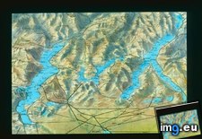
Pict. Northern Italy - Lake Region map (1919-1938).2886 (#Map #Lake #Italy #Northern #Region)Pict. 799×748 px★ 9703 pts. ♥ 0 likes ⬇ 8 saves
 Pict. [Mapporn] A World Map [4974x2519] (#World #Map )Pict. 4974×2519 px
★ 4429 pts. ♥ 0 likes ⬇ 8 saves
![[Mapporn] A World Map [4974x2519] (#World #Map ) - 1.6 MB Tags: map, world (Pict. in My r/MAPS favs)](https://t.im9.eu/mapporn-a-world-map-4974x2519.jpg) Pict. [Mapporn] Worldwide Map of Regional Subreddits with 10,000+ Subscribers [OC][1952x981] (#Map #Worldwide #Regional #Subreddits #Subscribers)Pict. 1952×981 px
Pict. [Mapporn] Worldwide Map of Regional Subreddits with 10,000+ Subscribers [OC][1952x981] (#Map #Worldwide #Regional #Subreddits #Subscribers)Pict. 1952×981 px★ 5996 pts. ♥ 0 likes ⬇ 11 saves
![[Mapporn] Worldwide Map of Regional Subreddits with 10,000+ Subscribers [OC][1952x981] (#Map #Worldwide #Regional #Subreddits #Subscribers) - 157 KB Tags: map, regional, subreddits, subscribers, worldwide (Pict. in My r/MAPS favs)](https://t.im9.eu/mapporn-worldwide-map-of-regional-subreddits-with-10-000-subscribers-oc-1952x981.jpg)