★ 7398 pts. ♥ 0 likes ⬇ 13 saves
![[Mapporn] Percentage of CO2 emissions-free electricity generation by province-state (North America) [2289x1744] (#Free #State #North #Generation #Electricity) - 244 KB Tags: america, electricity, free, generation, north, percentage, province, state (Pict. in My r/MAPS favs)](https://t.im9.eu/mapporn-percentage-of-co2-emissions-free-electricity-generation-by-province-state-north-america-2289x1744.jpg) GIF [Dataisbeautiful] Obesity rates in America throughout the years (#Years #America #Rates #Obesity)GIF 612×451 px
GIF [Dataisbeautiful] Obesity rates in America throughout the years (#Years #America #Rates #Obesity)GIF 612×451 px★ 2861 pts. ♥ 0 likes ⬇ 6 saves
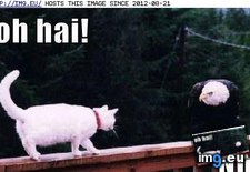
![[Dataisbeautiful] Obesity rates in America throughout the years (#Years #America #Rates #Obesity) - 678 KB Tags: america, obesity, rates, years (GIF in My r/DATAISBEAUTIFUL favs)](https://t.im9.eu/dataisbeautiful-obesity-rates-in-america-throughout-the-years.jpg) Pict. funny pictures - Lolcats: Friendship America Style (#Funny #Style #America #Lolcats #Friendship)Pict. 435×273 px
Pict. funny pictures - Lolcats: Friendship America Style (#Funny #Style #America #Lolcats #Friendship)Pict. 435×273 px★ -8530 pts. ♥ 0 likes ⬇ 6 saves
 Pict. [4chan] British Anon visits America (#4chan #Anon #British #America #Visits)Pict. 852×1111 px
★ -6961 pts. ♥ 0 likes ⬇ 6 saves
![[4chan] British Anon visits America (#4chan #Anon #British #America #Visits) - 129 KB Tags: 4chan, america, anon, british, visits (Pict. in My r/4CHAN favs)](https://t.im9.eu/4chan-british-anon-visits-america.jpg) GIF [Mapporn] Map of red and blue America 1960-2004 [GIF] [1583 x 1119] (#Gif #Map #Red #Blue #America)GIF 1583×1119 px
GIF [Mapporn] Map of red and blue America 1960-2004 [GIF] [1583 x 1119] (#Gif #Map #Red #Blue #America)GIF 1583×1119 px★ 5569 pts. ♥ 0 likes ⬇ 5 saves
![[Mapporn] Map of red and blue America 1960-2004 [GIF] [1583 x 1119] (#Gif #Map #Red #Blue #America) - 2.3 MB Tags: america, blue, gif, map, red (GIF in My r/MAPS favs)](https://t.im9.eu/mapporn-map-of-red-and-blue-america-1960-2004-gif-1583-x-1119.jpg) Pict. [Mapporn] Educational Puzzle Map from 1814, “A New Map of America, Dissected for the Instruction of Youth in Geography.” Made by (#Map #America #Geography #Instruction #Dissected)Pict. 1798×2667 px
Pict. [Mapporn] Educational Puzzle Map from 1814, “A New Map of America, Dissected for the Instruction of Youth in Geography.” Made by (#Map #America #Geography #Instruction #Dissected)Pict. 1798×2667 px★ 7387 pts. ♥ 0 likes ⬇ 7 saves
![[Mapporn] Educational Puzzle Map from 1814, “A New Map of America, Dissected for the Instruction of Youth in Geography.” Made by (#Map #America #Geography #Instruction #Dissected) - 850 KB Tags: america, dissected, educational, geography, instruction, map, puzzle, youth (Pict. in My r/MAPS favs)](https://t.im9.eu/mapporn-educational-puzzle-map-from-1814-a-new-map-of-america-dissected-for-the-instruction-of-youth-in-geography-made-by-william-dalton-26-january-1814-1798x2667.jpg) Pict. [Aww] Every dog in America right now (#Dog #Now #America)Pict. 1024×768 px
Pict. [Aww] Every dog in America right now (#Dog #Now #America)Pict. 1024×768 px★ 13k pts. ♥ 0 likes ⬇ 8 saves
![[Aww] Every dog in America right now (#Dog #Now #America) - 108 KB Tags: america, dog, now (Pict. in My r/AWW favs)](https://t.im9.eu/aww-every-dog-in-america-right-now.jpg) Pict. [Mapporn] South America in globular perspective, published as a foldout supplement from the December 1937 issue of Fortune magaz (#South #America #Issue #Globular #Foldout #Magaz #Supplement)Pict. 4115×5080 px
Pict. [Mapporn] South America in globular perspective, published as a foldout supplement from the December 1937 issue of Fortune magaz (#South #America #Issue #Globular #Foldout #Magaz #Supplement)Pict. 4115×5080 px★ 8224 pts. ♥ 0 likes ⬇ 9 saves
![[Mapporn] South America in globular perspective, published as a foldout supplement from the December 1937 issue of Fortune magaz (#South #America #Issue #Globular #Foldout #Magaz #Supplement) - 3.9 MB Tags: america, foldout, fortune, globular, issue, magaz, perspective, published, south, supplement (Pict. in My r/MAPS favs)](https://t.im9.eu/mapporn-south-america-in-globular-perspective-published-as-a-foldout-supplement-from-the-december-1937-issue-of-fortune-magazine-4115x5080.jpg) Pict. [Mapporn] The Unofficial Comfort Foods of Every State in America [2000x1356] (#State #America #Foods #Comfort)Pict. 2000×1356 px
Pict. [Mapporn] The Unofficial Comfort Foods of Every State in America [2000x1356] (#State #America #Foods #Comfort)Pict. 2000×1356 px★ 5144 pts. ♥ 0 likes ⬇ 17 saves
![[Mapporn] The Unofficial Comfort Foods of Every State in America [2000x1356] (#State #America #Foods #Comfort) - 127 KB Tags: america, comfort, foods, state (Pict. in My r/MAPS favs)](https://t.im9.eu/mapporn-the-unofficial-comfort-foods-of-every-state-in-america-2000x1356.jpg) Pict. [Mapporn] Very pretty map showing the mean air temperature in North America for February, 1979 (Temp in °C) [2367x3686] (#Pretty #Map #Showing #Temperature #February)Pict. 2367×3686 px
Pict. [Mapporn] Very pretty map showing the mean air temperature in North America for February, 1979 (Temp in °C) [2367x3686] (#Pretty #Map #Showing #Temperature #February)Pict. 2367×3686 px★ 7040 pts. ♥ 0 likes ⬇ 9 saves
![[Mapporn] Very pretty map showing the mean air temperature in North America for February, 1979 (Temp in °C) [2367x3686] (#Pretty #Map #Showing #Temperature #February) - 1.1 MB Tags: air, america, february, map, north, pretty, showing, temperature (Pict. in My r/MAPS favs)](https://t.im9.eu/mapporn-very-pretty-map-showing-the-mean-air-temperature-in-north-america-for-february-1979-temp-in-c-2367x3686.jpg) Pict. [Mapporn] Map of North America in the style of Tolkien's Middle-Earth maps (lotr) [1000x1200] (#Map #North #Earth #Lotr #Tolkien)Pict. 1000×1200 px
Pict. [Mapporn] Map of North America in the style of Tolkien's Middle-Earth maps (lotr) [1000x1200] (#Map #North #Earth #Lotr #Tolkien)Pict. 1000×1200 px★ 6118 pts. ♥ 0 likes ⬇ 3 saves
![[Mapporn] Map of North America in the style of Tolkien's Middle-Earth maps (lotr) [1000x1200] (#Map #North #Earth #Lotr #Tolkien) - 217 KB Tags: america, earth, lotr, map, maps, north, style, tolkien (Pict. in My r/MAPS favs)](https://t.im9.eu/mapporn-map-of-north-america-in-the-style-of-tolkien-s-middle-earth-maps-lotr-1000x1200.jpg) Pict. [Earthporn] On the highest paved road in North America: Mount Evans, Colorado (3984x2241) [OC] (#North #Road #Colorado #Evans #Paved)Pict. 3984×2241 px
Pict. [Earthporn] On the highest paved road in North America: Mount Evans, Colorado (3984x2241) [OC] (#North #Road #Colorado #Evans #Paved)Pict. 3984×2241 px★ 340k pts. ♥ 0 likes ⬇ 5 saves
![[Earthporn] On the highest paved road in North America: Mount Evans, Colorado (3984x2241) [OC] (#North #Road #Colorado #Evans #Paved) - 1.5 MB Tags: america, colorado, evans, highest, mount, north, paved, road (Pict. in My r/EARTHPORN favs)](https://t.im9.eu/earthporn-on-the-highest-paved-road-in-north-america-mount-evans-colorado-3984x2241-oc.jpg) Pict. LATIN AMERICA CALL CENTER COSTA RICA WORK (#Work #America #Center #Latin #Costa #Rica)Pict. 1250×1660 px
Pict. LATIN AMERICA CALL CENTER COSTA RICA WORK (#Work #America #Center #Latin #Costa #Rica)Pict. 1250×1660 px★ 21k pts. ♥ 0 likes ⬇ 14 saves
 Pict. [Funny] America’s Most Bizarre Laws Illustrated In Photo Series By Olivia Locher. 6 (#Funny #Photo #Series #Laws #Bizarre #Locher)Pict. 605×756 px
★ 3927 pts. ♥ 0 likes ⬇ 12 saves
![[Funny] America’s Most Bizarre Laws Illustrated In Photo Series By Olivia Locher. 6 (#Funny #Photo #Series #Laws #Bizarre #Locher) - 55 KB Tags: america, bizarre, funny, illustrated, laws, locher, olivia, photo, series (Pict. in My r/FUNNY favs)](https://t.im9.eu/funny-america-s-most-bizarre-laws-illustrated-in-photo-series-by-olivia-locher-6.jpg) Pict. [Mapporn] Someone elsewhere on Reddit said you guys would like my British map of North America from 1759 [4608x3456] (#Guys #Map #North #British #America #4608x3456)Pict. 2765×2074 px
Pict. [Mapporn] Someone elsewhere on Reddit said you guys would like my British map of North America from 1759 [4608x3456] (#Guys #Map #North #British #America #4608x3456)Pict. 2765×2074 px★ 6043 pts. ♥ 0 likes ⬇ 9 saves
![[Mapporn] Someone elsewhere on Reddit said you guys would like my British map of North America from 1759 [4608x3456] (#Guys #Map #North #British #America #4608x3456) - 787 KB Tags: 4608x3456, america, british, guys, map, north (Pict. in My r/MAPS favs)](https://t.im9.eu/mapporn-someone-elsewhere-on-reddit-said-you-guys-would-like-my-british-map-of-north-america-from-1759-4608x3456.jpg) Pict. [Mapporn] [OC] United Borders of America: A Map Outlining the Geographic Features that compose the borders between all 50 US Sta (#Map #United #America #Sta #Compose #Outlining)Pict. 2000×1237 px
Pict. [Mapporn] [OC] United Borders of America: A Map Outlining the Geographic Features that compose the borders between all 50 US Sta (#Map #United #America #Sta #Compose #Outlining)Pict. 2000×1237 px★ 7243 pts. ♥ 0 likes ⬇ 5 saves
![[Mapporn] [OC] United Borders of America: A Map Outlining the Geographic Features that compose the borders between all 50 US Sta (#Map #United #America #Sta #Compose #Outlining) - 184 KB Tags: america, borders, compose, features, geographic, map, outlining, sta, united (Pict. in My r/MAPS favs)](https://t.im9.eu/mapporn-oc-united-borders-of-america-a-map-outlining-the-geographic-features-that-compose-the-borders-between-all-50-us-states-2000-1732.jpg) Pict. [Mapporn] A Pictorial Map of the United States of America: Showing Principal Regional Resources, Products and Natural Features. (#Map #Showing #Natural #Regional #Features #Principal #Products)Pict. 1800×2715 px
Pict. [Mapporn] A Pictorial Map of the United States of America: Showing Principal Regional Resources, Products and Natural Features. (#Map #Showing #Natural #Regional #Features #Principal #Products)Pict. 1800×2715 px★ 7891 pts. ♥ 0 likes ⬇ 8 saves
![[Mapporn] A Pictorial Map of the United States of America: Showing Principal Regional Resources, Products and Natural Features. (#Map #Showing #Natural #Regional #Features #Principal #Products) - 1.1 MB Tags: america, features, map, natural, principal, products, regional, showing, states, united (Pict. in My r/MAPS favs)](https://t.im9.eu/mapporn-a-pictorial-map-of-the-united-states-of-america-showing-principal-regional-resources-products-and-natural-features-1954-2715x1800.jpg) Pict. [Mapporn] The United States of North America with the British territories and those of Spain (1796) [4968×4191] (#North #States #America #Spain #Territories)Pict. 4968×4191 px
Pict. [Mapporn] The United States of North America with the British territories and those of Spain (1796) [4968×4191] (#North #States #America #Spain #Territories)Pict. 4968×4191 px★ 6367 pts. ♥ 0 likes ⬇ 13 saves
![[Mapporn] The United States of North America with the British territories and those of Spain (1796) [4968×4191] (#North #States #America #Spain #Territories) - 2.3 MB Tags: america, british, north, spain, states, territories, united (Pict. in My r/MAPS favs)](https://t.im9.eu/mapporn-the-united-states-of-north-america-with-the-british-territories-and-those-of-spain-1796-4968-4191.jpg) Pict. [Mapporn] Martin Waldseemüller’s 1507 map. The first map to apply the name 'America' to the new world. [2000x1114] (#World #Map #America #Martin #Apply)Pict. 2000×1114 px
Pict. [Mapporn] Martin Waldseemüller’s 1507 map. The first map to apply the name 'America' to the new world. [2000x1114] (#World #Map #America #Martin #Apply)Pict. 2000×1114 px★ 5444 pts. ♥ 0 likes ⬇ 12 saves
![[Mapporn] Martin Waldseemüller’s 1507 map. The first map to apply the name 'America' to the new world. [2000x1114] (#World #Map #America #Martin #Apply) - 712 KB Tags: america, apply, map, martin, world (Pict. in My r/MAPS favs)](https://t.im9.eu/mapporn-martin-waldseem-ller-s-1507-map-the-first-map-to-apply-the-name-america-to-the-new-world-2000x1114.jpg) Pict. [Mapporn] Early exploration of North America by Spain [1934×1400] (#North #Early #America #Spain #Exploration)Pict. 1934×1400 px
Pict. [Mapporn] Early exploration of North America by Spain [1934×1400] (#North #Early #America #Spain #Exploration)Pict. 1934×1400 px★ 5564 pts. ♥ 0 likes ⬇ 13 saves
![[Mapporn] Early exploration of North America by Spain [1934×1400] (#North #Early #America #Spain #Exploration) - 629 KB Tags: america, early, exploration, north, spain (Pict. in My r/MAPS favs)](https://t.im9.eu/mapporn-early-exploration-of-north-america-by-spain-1934-1400.jpg) Pict. [Funny] America’s Most Bizarre Laws Illustrated In Photo Series By Olivia Locher. 14 (#Funny #Photo #Series #Laws #Bizarre #Locher)Pict. 605×756 px
Pict. [Funny] America’s Most Bizarre Laws Illustrated In Photo Series By Olivia Locher. 14 (#Funny #Photo #Series #Laws #Bizarre #Locher)Pict. 605×756 px★ 3973 pts. ♥ 0 likes ⬇ 11 saves
![[Funny] America’s Most Bizarre Laws Illustrated In Photo Series By Olivia Locher. 14 (#Funny #Photo #Series #Laws #Bizarre #Locher) - 60 KB Tags: america, bizarre, funny, illustrated, laws, locher, olivia, photo, series (Pict. in My r/FUNNY favs)](https://t.im9.eu/funny-america-s-most-bizarre-laws-illustrated-in-photo-series-by-olivia-locher-14.jpg) Pict. [Funny] America’s Most Bizarre Laws Illustrated In Photo Series By Olivia Locher. 2 (#Funny #Photo #Series #Laws #Bizarre #Locher)Pict. 605×756 px
Pict. [Funny] America’s Most Bizarre Laws Illustrated In Photo Series By Olivia Locher. 2 (#Funny #Photo #Series #Laws #Bizarre #Locher)Pict. 605×756 px★ 3900 pts. ♥ 0 likes ⬇ 10 saves
![[Funny] America’s Most Bizarre Laws Illustrated In Photo Series By Olivia Locher. 2 (#Funny #Photo #Series #Laws #Bizarre #Locher) - 55 KB Tags: america, bizarre, funny, illustrated, laws, locher, olivia, photo, series (Pict. in My r/FUNNY favs)](https://t.im9.eu/funny-america-s-most-bizarre-laws-illustrated-in-photo-series-by-olivia-locher-2.jpg) Pict. [Mapporn] Racial Dot-Density Map of District 5 in Florida, one of the most gerrymandered Congressional Districts in America (881 (#One #Map #America #District #Districts #Congressional #Racial)Pict. 881×1178 px
Pict. [Mapporn] Racial Dot-Density Map of District 5 in Florida, one of the most gerrymandered Congressional Districts in America (881 (#One #Map #America #District #Districts #Congressional #Racial)Pict. 881×1178 px★ 7571 pts. ♥ 0 likes ⬇ 12 saves
![[Mapporn] Racial Dot-Density Map of District 5 in Florida, one of the most gerrymandered Congressional Districts in America (881 (#One #Map #America #District #Districts #Congressional #Racial) - 425 KB Tags: america, congressional, density, district, districts, dot, florida, map, one, racial (Pict. in My r/MAPS favs)](https://t.im9.eu/mapporn-racial-dot-density-map-of-district-5-in-florida-one-of-the-most-gerrymandered-congressional-districts-in-america-881x1178.jpg) Pict. James Brown - Living In America (#Living #Brown #America #James)Pict. 800×550 px
Pict. James Brown - Living In America (#Living #Brown #America #James)Pict. 800×550 px★ -56913 pts. ♥ 0 likes ⬇ 5 saves
